GPS Hikes Page
Our most recent 100 Hikes (7-10 mile walks) with GPS files are listed below with the newest first. All our GPS Routes can always be seen at Outdooractive. For a webpage of GPS Ambles (4-6 mile walks) see here.
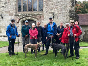
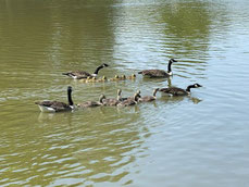
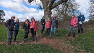
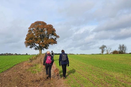
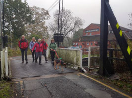
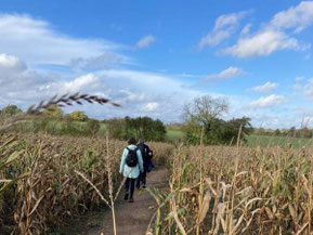
Meriden Figure of 8 Hike

Adrian Jones led this walk on Sat 6 Apr. By popular request this was a repeat of the the walk he led on 10 Feb and is in two parts; the first is north from Meriden and is about 4 miles long. It is mostly on footpaths, with some woodland, some short lengths of lane and 4 or 5 stiles. The second part is south from Meriden and almost all of it is on footpaths.
The Alternative Commonwealth Games Circular

Jane and Colin led this walk of around 8 miles from Perry Barr Station (Birchfield Road, Perry Barr, B20 3JE) on Sat 9 Mar. We followed walk 13 from A-Z Birmingham Hidden Walks: Discover 20 routes in and around the city which is available at "Amazon and all good booksellers". The walk is on pavements, canal towpaths and uneven park paths and the following notes come from the guidebook:
'There's never been a better time for Birmingham to tell its story' according to Peaky Blinders creator and opening ceremony producer, Steven Knight, on the event that will change the city's image for generations of people. The focal point of the 2022 Commonwealth Games is the renovated Alexander Stadium, which features on this walk along with the athletes' village that never was, as well as a cemetery and an iconic landmark rarely traversed on foot.
This walk of contrasts starts in the northern suburb of Perry Barr, 4 miles (6.7 km) from the city centre. You will discover a charming lock-keeper's cottage hidden from view. You will walk through Birmingham's largest cemetery with a spectacular chapel offering one of the best vantage points over the City, and where dignified graves remind us of the shared history that the Commonwealth nations have beyond sport.
Approaching along the Tame Valley Canal you will pass under north Birmingham's temple to brutalism: Spaghetti Junction- With the tangle of roads spiralling above, there is a surprising calm along the tree-lined canal-side. These are some of Birmingham's least-visited gems that offer a rewarding experience for the more adventurous explorer.
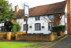
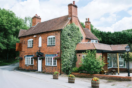
A Hike from the Railway Inn, Dorridge

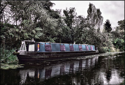
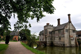
Sue and Bill Kiely led this walk of just over 8 miles from the Railway Inn, Dorridge on Sun 25 Feb. Leaving the Railway Inn, we headed to Packwood Church before skirting Packwood House grounds and dropping onto the Grand Union Canal, crossing to the Stratford-upon-Avon Canal, leaving the canal at the Drawbridge, and returning to the Railway Inn via fields, copses and lanes. Only a few stiles, but quite a lot of mud!
The address for the Railway Inn is Grange Road, Dorridge, B93 8QA. Click the following link for directions in Google Maps.
A Figure of 8 Hike from Meriden

A walk of around 7.5 miles led by Adrian Jones. The route is in two parts; the first is north from Meriden and is about 4 miles long. It is mostly on footpaths, with some woodland and some short lengths of lane. The second part is south from Meriden and almost all on footpaths through fields. (Note that, by popular request, Adrian repeated this walk on 6 April.)
Black Boy Loop

Evan Grant led this walk of 14.2km (8.8 miles) from The Black Boy (Warwick Road, Knowle, Solihull, B93 0EB - directions in Google Maps) on Sun 28 Jan. The route follows the Grand Union Canal before turning up the Stratford Canal and following footpaths and quiet roads past Packwood House and St Giles Church to Dorridge Park. The route continues along Dorridge streets and through some more fields before re-joining the Grand Union at The King's Arms and finishing back along the towpath. There are some kissing gates and stiles, a couple of which are not dog-friendly. There were several places that were very muddy when we did this walk.
A Hike from Coughton

A walk of 8 miles / 13km , based on this route from OSMaps.com, led by Tas Hind on Sun 14 Jan from The Throckmorton, Coughton Hill, Alcester, Warwickshire, B49 5HX (directions in Google Maps). The route is on footpaths over fields and through woods, and on some quiet lanes. Expect a fair amount of mud in winter.
New Year's Day Hike from Berkswell

Jane Hodge led our New Year's Day walk for 2024 from The Bear Inn, Berkswell, CV7 7BB (Google Maps). We walked 7.8 miles (12.6km) in bright, clear weather, though it was very muddy underfoot. The online map linked below shows a variation of the route which is slightly shorter at 7 1/2 miles, and avoids a private footpath we were able to use on the day of the walk.
Mulled Wine & Mince Pies Walk from Kenilworth
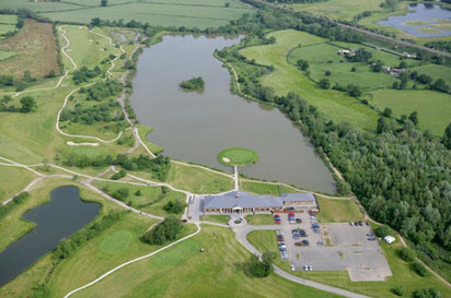
Thanks to Sharron & Pete for leading their festive Mulled Wine & Mince Pies Walk from Abbey Fields Car Park, Kenilworth on Sat 16 Dec. The route of 8.5 miles offers easy walking through the Warwickshire countryside skirting The Warwickshire golf course towards Leek Wootton Church where we stopped for Mulled Wine and Mince Pies! Continuing on, the route passes County Police Headquarters and then heads back towards Kenilworth. The walk is suitable for dogs and there are no stiles.
Hidden Birmingham
Mary Coles led this walk of just over 10 miles in Hidden Birmingham! This urban walk starts from New St Station and follows some of the Platinum Jubilee Walkway. It takes in the Georgian and Jewellery Quarters of the City, including the Warstone Lane Cemetery. It follows the canal to the NIA and Roundhouse before heading to the Edgbaston Reservoir, the Harborne Walkway and some smart residential streets in Harborne and Edgbaston. Finally, the route heads back to the City Centre along the Worcester & Birmingham Canal. If anyone wants to do a shorter walk they can dip out at the NIA after about 3.5 miles or take a bus back to the centre from Harborne.
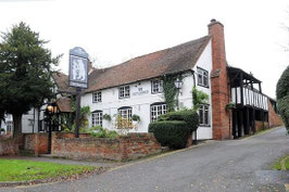
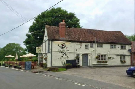
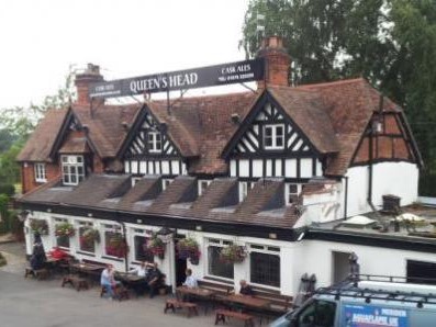
A Hike from The Queen's Head
A circular walk of around 9 miles led by Steve White from The Queen's Head in Meriden on Sun 19 Nov. The address for The Queen's Head is Old Rd, Meriden, Coventry CV7 7JP and you can find it here in Google Maps. The route goes to Hawks End and back past the edge of Corley Moor on footpaths and quiet lanes.
A Hike in Sutton Park
A walk of just over 8 miles (13 km) in Sutton Park led by John & Sue Timperley from the car park at the Toby Carvery, Sutton Park, Sutton Coldfield B74 2YT on Sat 4 Nov 2023
A Hike from Lapworth
This walk was led by Sue & Bill Kiely from The Navigation Inn, Old Warwick Road, Lapworth, B94 6NA (Google Maps) starting at 9:30am on Sat 21 Oct. The route of 7miles / 11.2 km passes through Baddesley Clinton, Rowington and the edge of Lowsonford before following canal towpaths back to The Navigation Inn. The walk is a lovely mix of fields, lanes, and canalside paths.
A Hike from Corley Moor

Colin & Jane Niblock led a walk of around 8 miles from The Bull & Butcher, Common Lane, Corley Moor, Coventry CV7 8AQ (Google Maps) starting at 9:30am on Sat 7 Oct. There is plenty of parking at the pub. Please note that on this route there are some difficult stiles which will be especially challenging for anyone with dogs, and that there are cattle in the fields by Green End Farm. Part of the route follows Pump Lane, a very pleasant single track road, but none of it is on main roads.
A Hike from The Bear Inn, Berkswell
Wayman & Beverley led a walk on Sun 24 Sep from The Bear Inn, Berkswell (Google Maps). The route of just over 8.5 miles (13.7km) skirts Eastern Green and then comes back via Millison’s Wood and Meriden. The walk is mainly on footpaths across fields with a short detour into Millison’s Wood.
A Hike from Bubbenhall
This walk started from The Three Horseshoes, Bubbenhall, CV8 3BD on Saturday 9th. September at 9.30am and was led by Bob Reid. The route of approx 8 1/2 miles (13 1/2 km) is mainly on rural footpaths, and passes through Weston under Wetherley, Hunningham and Wappenbury.
A Hike from Barston
This walk was led by Denis Pratt from The Bulls Head in Barston, B92 0JU starting at 9:30am on Sat 26 Aug. The route was just under 10 miles long with canal and countryside walking.
A Hike from Kenilworth

Angus and Tracey Mills led this walk of around 9.8 miles (15.7km) starting from Abbey Fields Car Park in Kenilworth at 9:15am on Sat 12 Aug. There is a van in the car park serving coffee and cakes which is open from around 9am. Many in the group visited The Virgins & Castle, a nearby pub, for post-walk refreshment and lunch.
For parking fees, see the Car Park link above. When we visited it was possible to pay by card or in the RingGo app (location 23851) but not with cash.
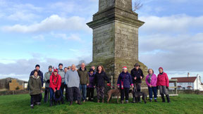
Gate Pillars - Umberslade Obelisk – St Mary's Church loop from Tanworth-in-Arden
A loop of 9 miles / 14.4km from Tanworth-in-Arden through local countryside from The Bell, The Green, Tanworth-in-Arden and led on 30 Jul 2023 by Evan Grant. Landmarks include the Umberslade Gate Pillars, the Umberslade Obelisk, the Church of St Mary the Virgin, Lapworth and a mock windmill also in Lapworth. Many of the paths were overgrown when we walked this route and there were also many awkward and poorly maintained stiles.
There is limited parking behind the pub, but please park out on the street if possible.
A Walk Around Hatton Locks
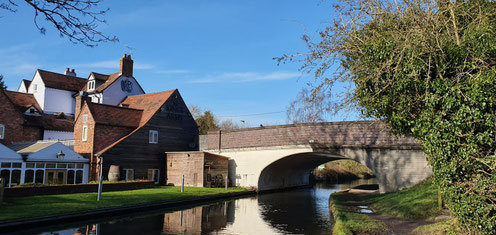
This walk of around 9 miles was led by Tas Hind from the Hatton Arms car park, CV35 7JJ, on Sun 16 Jul. Some 50% of the route follows the towpath of the Grand Union Canal, the remainder being on rural footpaths around the villages of Little Shrewley and Hatton.
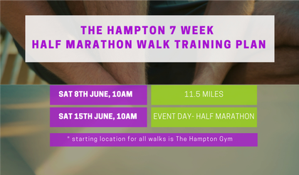
Half Marathon Walk
This walk was a half marathon walk starting from and finishing at The Hampton Gym, Old Station Road, Hampton in Arden, B92 0HA. The walk, and the training walks leading up to it, were organised to raise money for the Cameron Grant Memorial Trust. All donations very welcome at: www.totalgiving.co.uk/mypage/hampton-half
A 10 Mile Walk from the Hampton Gym
This 10 mile walk was led by Angus and Tracey Mills on Sun 4 Jun 2023 and started from The Hampton, Station Court, Old Station Road, Hampton in Arden, B92 0HA.
This walk is one of a series of practice walks for the Hampton half marathon walk (see this pdf file for details) on June 17th in aid of the Cameron Grant Memorial Trust.
7 Mile Walk from The Hampton Gym
This 7 mile walk to Barston and back on Sun 21 May was led by Evan Grant from The Hampton, Station Court, Old Station Road, Hampton-in-Arden, Solihull, B92 0HA.
This Hampton Hike was also one in a series of training walks organised by The Hampton gym with Hampton Hikers in advance of a Half Marathon Walk on 17 June to raise funds for Cameron Grant Memorial Trust. For full details, including how to enter the Half Marathon Walk, please see this PDF: Half Marathon Walk
A Circular Walk from The Quicken Tree
This walk was led by John Timperley from The Quicken Tree on the Meriden Road between Fillongley and Meriden on Monday May 8th, the Coronation Bank Holiday. The route of just under 8 miles follows footpaths, including part of the Heart of England Way, and quiet lanes through rolling North Warwickshire countryside. (Note that there are several tricky styles on this route, and some are especially challenging for medium or large dogs which must be carried over them.)
A Circular Walk from Aston Cantlow
This walk, on Saturday 22nd. April, started from the Aston Cantlow Park at 9.30 am and was led by Denis Pratt. The walk of around 9 miles, went across farmland along a canal and through villages including past Mary Arden's farm.
Car parking is either by the village hall, B95 6HZ, or the The Kings Head, B95 6HY.
It is reputed that William Shakespeare used to visit the Kings Head.
A Circular Walk from Whitacre Heath
This walk was led by Bob Reid from The Swan, Whitacre Heath, B46 2JA on Easter Saturday. The walk is just over 7 miles long and is rated easy.
A Circular Walk from Hopwood House
This walk from Hopwood House, Hopwood, B48 7AB is approximately 9.5 miles long and was led by Sharron & Pete Maguire.
The route begins along the canal across Clifton Common and then on to the Bittell Reservoirs. After crossing the A441 the walk heads uphill towards Forhill before returning to the pub. Dog Walkers note: there are a couple of ladder stiles, a gate and a 200m stretch down a busy road with little verge.
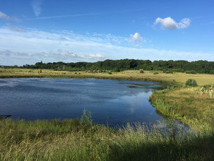
A Walk thro' an RSPB Nature Reserve

This walk of 6.7 miles (10.8 km) was led by Mary Coles on Sunday 12th March, and started from the car park at RSPB Middleton Lakes Nature Reserve (entrance on Bodymoor Heath Rd, Tamworth, B78 2BB. Drive on past the Aston Villa training ground. £3 pay and display charge per car or free to RSPB Members. Note also that you cannot get to the RSPB Car park by driving through Middleton Hall Car Park even though some satnavs suggest otherwise!)
Description: Very flat and mainly on gravel/tarmac paths through sections of the RSPB Middleton Lakes Nature Reserve and Kingsbury Water Park, along the Birmingham & Fazeley Canal and through woods. Close to the end, the route passes Middleton Hall where there is a convenient café for post-walk refreshment.
NOTE TO DOG WALKERS: for parts of the route through the RSPB Nature Reserve dogs must be on a short lead. There are other parts of the reserve where dogs are not allowed at the route described here avoids these.
A Macmillan Walk from Meriden
This walk was led by Anne Dewison from The Queen's Head, Meriden, CV7 7JP on Sunday 26th was around 7 miles long.
During the walk there was a stop for cakes and coffee, courtesy of Sara Carson who was raising money for Macmillan Cancer Support. This was party of a wider Carson family fundraising effort which includes Sara & Stuart's son Tom running the London Marathon on 23 April. If you missed the walk and would like to donate in support of Sara and family, please visit Tom’s fundraising page for Macmillan Cancer Support.
A Walk Around Hatton Locks
This walk of around 9 miles was led by Tas Hind from the Hatton Arms car park, CV35 7JJ, on Sun 12 Feb, 2023. Some 50% of the route follows the towpath of the Grand Union Canal, the remainder being on rural footpaths around the villages of Little Shrewley and Hatton.
A Walk from the Fleur de Lys

This walk was led by Wayman and Beverley from the Fleur De Lys, Lowsonford, B95 5HJ, on Sunday 29th January, 2023.
The walk of just over 8 miles goes through Yarningale Common, Preston Bagot and Henley in Arden. The walk is through fields (a few with horses and many with sheep), woodland and often near canals. There are some short hills. The route is typically quite wet, slippery and muddy in places in winter.
A Walk from from The Granville Arms in Barford
This walk was led by Anna Johnston from The Granville Arms, Barford, CV35 8DS. The route is around 8 miles long and goes from Barford to Wasperton, Charlecote, Hampton Lucy and Sherbourne and then back to Barford.
A Christmas Walk from Tanworth-in-Arden

This walk was led by Sharron & Pete Maguire on Saturday 17th December. The walk was the same as last year's Christmas route and started from The Bell in Tanworth-in-Arden, B94 5AL, at 9.30 am. The route of around 8 miles follows footpaths and quiet roads in a loop that returns to Tanworth through the Umberslade Estate. Mince pies and mulled wine were served!
A Walk from Rowington
This walk of about 8.5 miles was led by John and Sue Timperley and started from the Tom O' The Wood, Finwood Road, Rowington, Warwickshire, CV35 7DH at 9.30am on Sat 3 Dec.
A circular walk from Hampton-in-Arden through Temple Balsall
This walk was led by Mary Coles and on Sun 20 Nov from Fentham Hall car park in Hampton-in-Arden, B92 0AH. The walk followed footpaths through fields to Barston and on to Temple Balsall and then returned to Barston and Hampton-in-Arden on different paths. There is one short stretch on Balsall Street, a busy road, on the approach to Temple Balsall.
A circular walk from the Shirley Drawbridge
This walk of just over 9 miles was led by Evan Grant on Sun 6 Nov from the car park of the Drawbridge Inn (5 Drawbridge Road, Shirley, B90 1DD - Google Maps. Note: the car park entrance is on Haslucks Green Road).
The route begins by crossing the Stratford-upon-Avon Canal over the Shirley Drawbridge, then skirts Hollywood and goes through Wythall before crossing Fulford Heath Golf Club to Tanner's Green. It then crosses fields to Clowes Wood and follows the edge of Terry's Pool and Earlswood Lakes to Lady Lane and the canal. The route then follows the towpath to Dickens Heath and cuts through the village centre before returning to the towpath and following it back to and over the Shirley Drawbridge to the Drawbridge Inn.
A Circular Walk from Meer End to Kenilworth
This walk on Sunday 30th October was led by Sue & Bill Kiely from The Tipperary Inn at Meer End. The route includes some lovely woodland, open fields and copses on the Honiley Estate, quiet country lanes, some historic buildings including Honiley Church and Hall, Rudfyn Manor, and of course, Kenilworth Castle.
The walk takes us from Meer End to the edge of Chase Wood, then on to Honiley and Beausale, before reaching Kenilworth Castle. Here we join the Millenium Way on our route back to Meer End, across land formerly part of the hunting grounds of the Castle.
A Circular Walk from Gorcott Hill
This walk on 25th September was led by Bob Reid starting from The Holly Bush, Gorcott Hill, B98 9EN at 9.30 am.
The route of just over 7 miles is mainly through agricultural land and includes the villages of Ullenhall and Traps Green. When we did this walk there were some tricky stiles and some frisky bullocks. Please come prepared and take care!
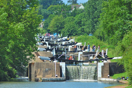
A Walk Around Warwick
This walk was led by Anna Johnston and started from Cape Road Carpark, Warwick, CV34 4LB, at 9.30am on Sunday 11th September. From the Car Park we went to St Nicholas Park then followed the riverside path along the Avon and crossed fields up to Old Milverton,. We passed the fascinating and eerie Guy's Cliffe, crossed over the weir and then went through The Saxon Mill. We followed the Centenary Way and came back through Hatton to join the Grand Union Canal at the middle of Hatton's famous 'stairway to heaven' flight of 21 locks, one of the longest in the country. We followed the canal back into Warwick and had an excellent lunch at The Globe.
A Walk from Catherine de Barnes
This walk was led by Denis Pratt from The Boat, Catherine-de-Barnes. The route starts along the towpath of the Grand Union Canal then crosses through fields to Dorridge and Knowle before returning to The Boat along the canal.
A Walk from Stirchley

This walk was led by Sarah Meharg; it started from the Ten Four Bakehouse, Unit 11, Stirchley Trading Estate, B30 2PF (sadly closed for a summer break when we were there) and ended at the Birmingham Brewing Company Taproom. The walk is 9 miles and is all pavement. The route follows the River Rea through parkland to Cannon Hill Park and cuts through Edgbaston before walking back via the Worcester & Birmingham Canal.
A Walk from Lowsonford

This walk from the Fleur De Lys pub, Lowsonford, B95 5HJ (Google Maps) on 5 June was led by Sharron and Pete Maguire and was a little over 9 miles in total. The route includes lovely pastures, wooded areas, a short stint along the Stratford Canal and beautiful countryside. The walk starts towards Bushwood, skirting both sides, then follows the Millennium Way towards Buckley Green where it picks up the Heart of England Way towards Preston Bagot. From there the route goes on to the canal towpath then across Yarningale Common and back to Lowsonford.
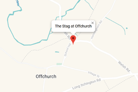
A Walk from The Stag at Offchurch
A 10+ mile circular walk through varied and beautiful Warwickshire countryside led by Angus & Tracey Mills. Starting from The Stag at Offchurch the route heads towards Newbold Comyn Park then winds its way along a charming section of the Grand Union Canal to Ridgeway Lane exiting the canal at this point and heading North to pick up the Millennium Way towards Hunningham. From Hunningham Hill the route continues along the Millennium Way to Hall Farm Meadow Nature Reserve before looping back around to Offchurch via more minor footpaths.
A Walk from Hampton-in-Arden
The walk led by Evan Grant on Saturday, 7th May started from Fentham Hall car park (B92 0AH, Google Maps) at 9.30am. This circular route of 9 miles goes to Barston via Barston Lakes and Bradnocks Marsh and returns via the Grand Union Canal towpath and Walsal End. Many thanks to Gill Shalley who chose the route.
Church End - Maxstoke - Coleshill Circuit
This walk from The Griffin Inn, Church Road, Shustoke, B46 2LB (Google Maps) on Sat 9 April was led by Evan Grant.
The route is a circuit of just over 10 miles on footpaths and quiet roads heading first to Maxstoke, and then to Coleshill before skirting Shustoke on the way back to The Griffin at Church End.
The Griffin has a large car park; please park at the far end from the pub. We had an excellent lucnh there after our walk.
Another walk from Church End Brewery

This walk on Sat 12 Mar was led by Angus and Tracey Mills and started from the Church End Brewery, Ridge Lane, CV10 0RD (Google Maps)
This is a 10 mile circular route through beautiful, undulating Warwickshire farmland. It begins in Ridge Lane and follows The Centenary Way (devised to celebrate one hundred years of Warwickshire County Council) to Over Whitacre, then heads East towards Old Arley before returning to Ridge Lane in a northerly direction via a collection of farms and through rolling countryside.
A walk from Church End Brewery
This walk was led by Sharron Maguire on 26 Feb 2022 from the Church End Brewery, Ridge Lane, Birchley Heath, CV10 0RD at 9.30 am. The route of around 9 miles encompasses woods, rural lanes, open fields, a canal towpath and Hartshill Hayes Country Park. We finished with lunch in the brewery Tap Room.
A Walk from The Crown Inn, Withybed Green led by Mary Coles
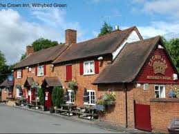
This walk started at The Crown Inn, Withybed Green, Alvechurch, Birmingham B48 7PN at 9.30 am on Sunday 13th February and was just under 9 miles. The route takes in Blackwell and Burcot. Note that the pub car park is quite small and is for 'patrons only'.
A Rural Walk from Sambourne
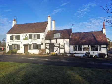
This walk, led by Bob Reid, started from The Green Dragon Inn, Sambourne, B96 6NU (Google Maps) at 9.30am and was just over 8 miles long. There is ample car parking space. At least 50% of the walk is on lanes to avoid mud where possible but there will always be some mud in winter and after prolonged rain. From Sambourne the route goes through the new Haydon Way Wood in the Heart of England Forest to Spernal, past the Purity Brewery, past Coughton Court and Park, and then back to Sambourne.
Local Hampton Lap
A circuit of around 9 1/2 miles (15 km) from the Fentham Hall Car Park (Marsh Lane, Hampton-in-Arden, B92 0AH - Google Maps). The route goes to the edge of Balsall Common then back to Hampton through Barston. The walk is mostly on footpaths through fields, though there are some stretches along roads. Expect a bit of mud if you walk this route in winter.
A Walk from Balsall Common

This walk of around 7 3/4 miles started from Ye Olde Saracen’s Head, Balsall Common, CV7 7AS, at 10.00 am on January 1st. This route is mainly across fields and meadows and was quite muddy for our New Year's Day walk. Waterproof boots are recommended. There is plenty of car parking space at the Saracen's Head.
A Walk from Tanworth-in-Arden

This walk of around 8 miles was led by Sharron Maguire from The Bell at Tanworth-in-Arden on Sun 19 Dec. The route follows footpaths and quiet roads in a loop that returns to Tanworth through the Umberslade Estate. Many thanks to Sharron & Pete for the mince pies and mulled wine!
A Walk from Meriden
This walk was led by Tas Hind from the The Bulls Head, Meriden, CV7 7NN. The route was inspired by the 8 mile Circular Walk from Meriden on the Millennium Way website and Berkswell from Meriden using the Millennium Way on Walking Britain. Compared to these, this route has been modified to accommodate HS2 footpath closures.
A Walk from Berkswell
A circular walk of almost 9 miles from The Bear Inn, Spencers Lane, Berkswell, CV7 7BB. The walk is mostly on footpaths through fields, though there are some short stretches along roads. There is ample car parking at The Bear.
A Walk in the Lickey & Waseley Hills
This walk was led by Bob Reid and started from the Oak Tree pub, Cofton Hacket, B45 8UX, at 9.30am on Sunday 24th. October. The walk is over 7 miles long and takes in both the Lickey and Waseley Hills. The walk starts in the Lickey Hills and progresses via Beacon Hill to the Waseley Hills and back via Chadwich Manor to the Lickeys and the Oak Tree. It includes several hills some of which are steep. The pub has a large carpark.
A Circular Walk from Meriden

This walk started from The Queen's Head in Meriden (CV7 7JP) and was led by Denis Pratt. The walk was approximately 8 miles long.
The route leaves the Queens Head carpark and continues along Eaves Green Lane, cutting across fields and passing under the A45, through Eaves Green village to a bridleway towards Corley Moor. From Corley Moor it skirts the edge of Birchley Hays Wood to the B4102 road which is obliquely crossed to footpaths going through Kinwalsey and Close Wood, High Ash Farm and back to the A45 which is crossed via the B4102 bridge. From there the walk followed a footpath across farmland back to Old Road and The Queen's Head.
A Walk from Alvechurch
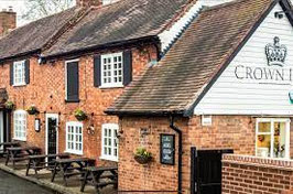
This walk of just over 5 miles was led by Debra Stojkovic from The Crown Inn, Alvechurch, B48 7PN. The route was part field, part canal towpath and part road, and included the village of Barnt Green.
Circular route from The Red Lion, Hopwas
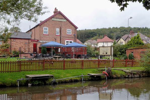
A 10 mile walk from The Red Lion at Hopwas led by Bob Reid on Sat 14 Aug, 2021. The walk starts with a short stretch of the Birmingham & Fazeley Canal soon transferring to a country lane for a little over a mile to a fruit farm. From there it passes along rural footpaths back to a four mile stretch of lanes and roads to and through Drayton Bassett and Bullock's End. The route then crosses the Coleshill Road and goes over the folly-like Drayton Footbridge, complete with turrets and spiral staircases, to the Birmingham and Fazeley Canal towpath which it follows to Fazeley Junction and then back to The Red Lion continuing along the Birmingham & Fazeley Canal towpath once more.
A Walk from the Navigation Inn
A walk of 9 3/4 miles led by Denis Pratt from the Navigation Inn on Sunday August 1st. This circular route is mostly on canal towpaths and footpaths through fields and visits Lowsonford, Rowington, Wroxall and Baddesley Clinton.
Hatton Arms Loop
This 10 mile walk was led by Angus & Tracey Mills from The Hatton Arms, CV35 7JJ on Saturday 17th July, 2021. A route description follows below, then some some photos and a map of the route with a link to a GPX file.
The route: walk through the pub grounds to the canal, cross at the brick bridge and continue straight ahead (walking away from the canal) to a wooden gate. The footpath continues ahead crossing the railway line over a bridge and passing Alders and Budbrooke farms where it becomes a track leading to a quiet road.
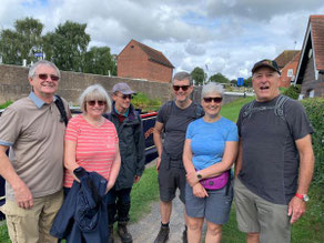
A Circular Walk from Lapworth
Our 7 mile (11.2km) walk began at the Navigation Inn, Lapworth, B94 6NA at 9.30 am on Sunday May 23rd and was led by Bob Reid. The walk is rated as easy with no significant hills.
From the start, the route heads across fields to Baddesley Clinton manor, past St Michael's Church and then across more fields to Rowington Green. From there it continues to Lowsonford mainly along back lanes to the South Stratford canal and then along the towpath to Kingsbury Junction and back to the Navigation.
A Circuit from Kingsbury led by Denis Pratt
This walk of around 9.5 miles starts from the free car park in Pear Tree Avenue, Kingsbury, B78 2LN and goes along the Heart of England Way across fields to join the Centenary Way. The route leaves the Centenary Way along another footpath to reach the River Tame follows the Tame, passes some beautiful pools, then returns to the start via Kingsbury Water Park.
The Royal Oak pub is close to the car park and handy for a visit after the walk.
A walk from Dobbies Atherstone led by Sarah Meharg

The walk starts and ends at Dobbies Atherstone, Cross Lane Farm, Nuneaton Road, Mancetter, Atherstone, Warwickshire CV9 1RF. The route is just over 5 1/2 miles long and covers a variety of terrain including uneven roadsides, hills and lots of mud (in winter). There are stunning views at various points along the walk and the cakes at Dobbies are recommended. The garden centre has a large car park which was almost empty when we began walking at 9am and almost full when we got back at around 11:30am.
A Circular Walk from Hunningham
This Walk, led by Bob Reid, started from The Red Lion Hunningham at 9.30 am on 2 Feb 2020.
Please see below for a selection of photos and a map of the route. For a full album from the walk, see: Photos from A Circular Walk from Hunningham. Many thanks to Mary Coles for the photos.
A walk from The King's Arms, Knowle
This walk is a loop of 6.4 miles from The King's Arms, Knowle, B93 0EE. The route starts along the Grand Union canal towpath and continues for 2 miles to Rising Lane bridge where it leaves the canal and proceeds to Packwood House and then back to the Grand Union via Packwood Road and Bakers Lane.
A map of the route follows below a selection of photos taken by Mary Coles on the walk. Many thanks to Tas Hind for leading.
Alvecote Circuit
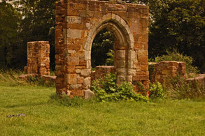
This 7 mile walk starts from the Samuel Barlow pub in Alvecote, B78 1AS. It passes the ruins of Alvecote Priory, Shuttington and the historic town of Polesworth then finishes along the towpath of the Coventry Canal. Most of the route is on tracks and roads to minimise mud.
A map of the route follows below the gallery of photos by Mary Coles.
A Walk in the Clent and Waseley Hills
This walk of just over 9 miles starts and ends at the Walton Hill Car Park on Walton Hill Road in the Clent Hills. Our route goes through the Clent Hills before moving east to Waseley Hills Country Park and then looping back to the start and includes three principal summits: Walton Hill (316m), Windmill Hill (285m) and Clent Hill itself (309m).
A Walk from The Boot Inn led by Gill Shalley
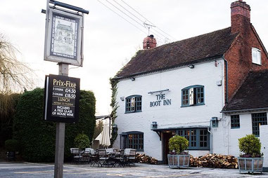
This walk led by Gill Shalley started from The Boot at Lapworth, B94 6JU, at 10.00 am on 6 Oct. The route was an 8 mile circuit taking in the canal towpath, fields and the grounds of Packwood House.
A Walk from Portway led by Bob Reid
A circuit of around 7 1/2 miles from The Rose and Crown at Portway, B48 7JD, this walk is mainly across agricultural land, passing over the Hob Hill trig point, around Rowney Green and near to Newbourne Wood nature reserve before returning to the Rose and Crown. The walk has a few inclines, some quite long, but no steep climbs. Some parts are overgrown in summer so shorts are not recommended. On the way there are wonderful views across Worcestershire and on a good day the Malvern Hills are clearly visible.
A walk from The Griffin Inn, Shustoke led by Evan Grant

This walk of 8.7 miles (14 km) from the The Griffin Inn, Church Rd, Shustoke, Coleshill B46 2LB (Google Maps) through rural North Warwickshire follows a loop north to Foul End then back past the Shustoke Reservoirs to The Griffin. Some stretches are on quiet country roads but for the most part this walk is on footpaths through fields. When we walked this route, we left from the far end of the car park at The Griffin over a stile into the neighbouring field, then walked along the edge of the field, following the hedge beside the B4114. This short section is not marked as a footpath on the map, though had clearly used been used as one when we were there. The alternative is to leave the car park by the car entrance and walk down the B4114, but please take great care as the B4114 is a narrow, busy road with no pavement or footpath.
Hampton to Barston and back
A 5 mile walk from the Hampton-in-Arden sports club carpark to Barston via Barston Lakes and the West Midlands Golf Club and back via Walsal End.
Hampton - Walsal End - Grand Union - Barston - Hampton
This walk of 8.5 miles (13.6 km) long follows the route shown on the map below; it leaves Hampton via footpaths to Walsal End and on past Henwood Hall Farm to the Grand Union Canal. The walk then follows the towpath to the bridge at Kixley Lane where it leaves the canal and crosses fields to Barston and on back to Hampton.
A Half Marathon Walk from the Gym
Check this route for disruption caused by HS2. Be prepared for detours for closed footpaths around the A452 and 16 Acre Wood.
11.5 mile "training walk" from the gym
An 11.5 mile circuit let by Bob Reid around Hampton-in-Arden starting at 10am on Sat 8 June from The Hampton Health & Fitness Club. Enjoy this as a walk in its own right, or as the last of the "training walks" organised in preparation for the Half Marathon Walk in support of Cameron Grant Memorial Trust on 15 June. If you would like to make a donation, please do so on this page at TotalGiving.
A 10 mile circuit from Hampton-in-Arden
Check this route for disruption caused by M42 J6 improvement work. Be prepared for detours for closed footpaths around Catherine-de-Barnes Lane.
A Walk from Hampton-in-Arden led by Gill Shalley
This walk starts at The Beeches Car Park in Hampton-in-Arden and makes its way to Barston then returns to Hampton via the Grand Union Canal and Walsal End.
A 17 mile circuit around Balsall Common
This route needs to be updated to accommodate HS2 diversions. Be prepared to follow diversions! Thanks.
Aston Cantlow - Alcester circuit

A 14 mile hike from The King’s Head in Aston Cantlow through Little Alne, Alcester, Little Britain, Red Hill and back to Aston Cantlow, this route follows sections of The Monarch's Way and The Arden Way and takes walkers through some of the finest landscape in Warwickshire.
A Hike from Brandon led by Mary Coles
An 8 mile circuit starting from the Royal Oak, Brandon, Coventry, CV8 3HR. The walk passes through Wolston, Church Lawford, Kings Newnham and Bretford before returning to Brandon. There are some very pretty villages and glorious open views. There are also quite a few stiles in the first half of the walk, and many are not dog-friendly. Car parking is available at the pub if you're drinking there after the walk. Please use car park opposite pub rather than the one next to it.
3 Ways Round Berkswell
Some parts of this route from 2019 will need to be modified because of HS2 work
Hike from Burton Green led by Sharron Maguire
Some parts of this walk may need to be modified because of HS2 work
A hike from Hatton led by Angus & Tracey

There will be a hike starting from the Hatton Arms,CV35 7JJ, starting at 9.30 am.
This is a shorter variant of the Hatton Walk that we have done previously, approximately 9 miles long. Easy walking mainly on bridleways, pavements, metalled tracks / minor roads and good canal towpaths with minimal mud: a banker for this time of year.
A New Years Day walk from Henley in Arden
This hike was led by Bob Reid from the Prince Harry Road Car Park in Henley-in-Arden (Set Sat Nav for 1 Fieldhouse Cl, Henley-in-Arden B95 5DF). The walk took us just under 3 1/2 hours.
This route is just under 8.5 miles long and is mainly along tracks and country lanes. Some of the walk gets muddy after heavy rain.
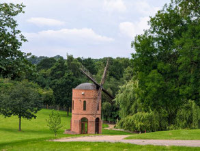
Lapworth - Obelisk - Hockley Heath circuit
A gentle 4 1/2 mile walk along footpaths and the towpath of the Stratford-upon-Avon Canal, this circuit includes a visit to the Umberslade Obelisk erected in 1749 for the first Lord Archer. You've seen it many times from the M40; now's the chance to get up close and personal!
A Hike from Knowle led by Bob Reid
A walk to be led by Bob Reid from Knowle at 9.00 am.
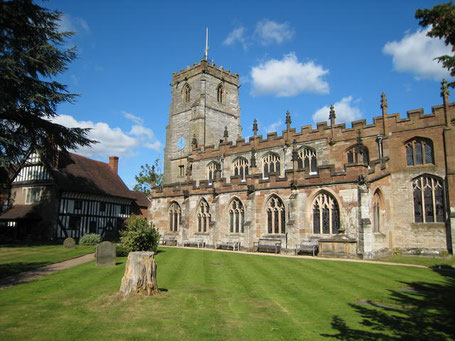
The walk will commence from Knowle Parish Church, B93 0LN, and will be approx. 8.5 miles long. There is limited street parking by the Church, otherwise there is a municipal car park just behind the church which is FOC on Sundays. This car park is accessed by turning off the High St. by The Greswolde Arms hotel and driving behind the hotel to the car park on the left, DO NOT go into the Greswolde car park on the corner.To walk from the car park leave by exit at the far left hand corner leading through the church yard. The walk is a mixture of country lanes, field footpaths and canal towpath and will pass through the historic villages of Barston and Temple Balsall.
Hampton Gym to Berkswell, Barston and back
This walk is not currently accessible because of HS2 work and will need to be modified to follow new footpaths when the work is complete. Evan Grant, 7 Feb 2022
A Circular Walk from the Navigation Inn, Lapworth
This walk begins at the Navigation Inn at Lapworth, B94 6NA and is approximately 9 miles long. The route is chosen to avoid crop fields and muddy towpaths as far as possible, and the walk leader when we walked this route on 14 Jan 2018 was Angus Mills.
A Walk from Kenilworth Led by Bob Reid
This walk started from the Abbey Fields carpark in Kenilworth, CV8 1BP. The car park is FOC on Sundays. The walk was approximately 8.5 miles long.
The walk commenced by crossing Abbey Fields to the road leading to the castle car park and turns right down a track just past the castle entrance. Go through a gate on the left to follow a path around the castle on the right to Purlieu Lane. Turn left along Purlieu Lane to a gate on the right way marked Millennium Way, proceed along Millennium Way across several fields to Chase Lane. Turn left on Chase Lane and continue past Chase Wood. Turn left at the end of Chase Wood down a farm track and then right at a way mark, through a hedge over a footbridge and up the a hill with the hedge close on the left, through a gate and turn left to another gate , Go through this gate and maintain direction across the field to a gate onto Church Road. Turn left onto Church Road and proceed past Honiley Hall and follow the road to Beausale keeping left at the screwed T-junction. Shortly past a cross roads with Dirty Lane turn left down Barracks Lane.
A Walk from The Hatton Arms led by Angus & Tracey Mills
This walk from the Hatton Arms, CV35 7JJ is a circular walk of about 10 miles, initially heading towards Warwick along the canal, leaving via a footpath by the locks at bridge 49, passing Woodloes Farm, skirting around Warwickshire Golf course and heading back to the Hatton Arms via Goldrest Farm, Bulloak Farm and Lower Farm. Easy walking: predominantly, a mixture of canal towpaths, urban footpaths and bridleways.
Rural walk around Berkswell and Balsall Common led by Bob Reid
This walk begins from The Brickmakers Arms, Berkswell, CV7 7EG. Cars may be parked at the pub or in the nearby station car park, CV7 7EF. The walk is just under 9 miles long with no steep inclines.
It is a rural walk through agricultural land and proceeds from The Brickmakers Arms through Barratt's Lane Farm, Beechwood, Carol Green, Benton Green to Berkswell village. From the village it follows the Heart of England Way to Balsall Street and then winds back past Grange Farm and through Balsall Common to The Brickmakers Arms.
Barnt Green & Lickey Hills Circuit
A walk from The Barnt Green Inn (Address: 22 Kendal End Road, Rednal, Birmingham, B45 8PZ. Directions)
The walk heads east to the Bittell Reservoirs then back west through Cofton Hackett and into the Lickey Hills and over the golf course. The route then returns to Barnt Green via Beacon Hill and Bilberry Hill.
A Walk from the Queen's Head, Meriden
A walk led by Gill Shalley from the Queen's Head, Meriden, CV7 7JP (Google Maps) via Eaves Green, Harvest Hill and Millison's Wood and back. Car parking is free in the car park next to the pub.
A Walk from Fenny Compton led by Mary Coles
This walk starts from The Merrie Lion in Fenny Compton, CV47 2YH (Google Maps). Cars may be parked in the pub car park on the understanding that refreshment will be taken at the end of the walk. Parking space is limited, so please car share where possible.
The walk is about 8.5 miles taking in the gentle rolling hills of Warwickshire. It progresses from Fenny Compton to Farnborough passing the impressive Farnborough Hall and then to Avon Dassett church and a short climb to the top of the Burton Hills with fabulous views across Warwickshire and beyond with the Malvern Hills visible on a clear day. It then drops down to Northend and back to Fenny Compton for aforementioned refreshment.
A Walk from Combrook Led by Lou Pearson
This walk is about 9.5 miles in length and you can park in the vicinity of St Mary & St Margaret Church (post code is CV35 9HP)
In the summer, some of the paths through woodland areas get a little overgrown with brambles so it is advisable to wear long trousers.
A Walk from Hampton to Catherine-de-Barnes and back via Ravenshaw and Eastcote
A walk from Hampton to Catherine de Barnes Common - "Catney Common", the only common land in Solihull - along the footpath above the Grand Union Canal to Damson Parkway. From there, along the towpath and across fields to Ravenshaw Hall and then via Eastcote back to Hampton.
Many thanks to Gill Shalley who planned and led the walk on 29 Jul 2017 when we started and finished at The Hampton Gym. There are many places you can choose to start and finish this walk; the route below is for a walk starting and finishing at The White Lion in Hampton where there is customer parking.
A Walk from the Fleur de Lys, Lowsonford via Buckley Green and Copt Green
This walk of approx 7 miles / 11 km was led by Kay Dick from the car park of the Fleur de Lys, Lowsonford (B95 5HJ). Walk directions:
From the pub car park turn right down the road to a telephone box and there take the footpath on the left and follow the Heart of England Way through a field on the right over a stile, cross two fields and then over a stile into a lane, turn right. After a short distance turn left through a double kissing gate and proceed along the edge of a field with the hedge close on the left to a wood, follow the HoE way through the wood.
A Walk from The Hampton Gym to Barston, Balsall St and back
This walk starts from The Hampton Gym, follows footpaths to Barston and Balsall Street, the Millennium Way/Heart of England Way to the West Midlands Golf Club and then footpaths back to the gym.
Starting from the Hampton Gym walk down Old Station Road to Meriden Road, turn right along Meriden Road crossing when safe and then turn left into Fentham Road. At the end of the road take the footpath on the left and follow it straight across fields and a small footbridge until until Oak Lane is reached.
Turn right and then left onto Barston Lane passing the Bulls Head pub. At the church, go through the churchyard via a path on the left which is followed around to the left past a path on the right which is not taken. At the end of the field go through a gate and follow the path across fields, crossing the river Blythe, until Barston Lane is reached and then turn right to Balsall Street.
A Circular Walk from Tanworth-in-Arden Led by Mary Coles

The Walk will start from The Bell in Tanworth in Arden, B94-5AL. Car parking is available at the rear of The Bell for those stopping for a drink at the end of the walk otherwise park on the Green.
This walk of around 9 1/2 miles explores the beautiful Warwickshire countryside. Starting from the Tanworth churchyard it proceeds across farmland crossing the Hobbditch to Ullenhall and from there over further farmland to Gorcott Hill, Traps Green and Aspley Heath back to Tanworth. The walk is over undulating countryside with several gradients of low to medium severity.
A Walk from the Crabmill at Preston Bagot led by Bob Reid
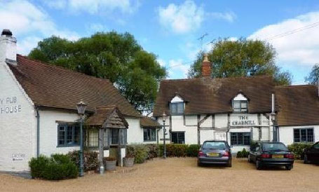
This walk from the car park at The Crabmill at Preston Bagot starts across country to the outskirts of Henley in Arden and then along the Heart of England way via Beaudesert Castle to the Millenium Way for some 2.5 miles to Copt Green. From there it proceeds via Bushwood Grange past Bush Wood to Preston Field Lane and then to the Stratford Canal for about 1/2 mile back to the Crabmill.
There are a number of steep gradients both up and down along this walk. The views over rural Warwickshire from the top of some of the hills are truly spectacular.
A Walk Led by Gill Shalley from Coughton Court
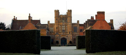
This walk of 11 miles leads to two National Trust properties, Coughton Court and The Kinwarton Dovecote, and follows the lovely River Arrow for some of its length.
The walk starts at The Throckmorton Arms (Coughton Hill, A435, Alcester, Warwickshire B49 5HX) and passes along the frontage of Coughton Court which is an imposing Tudor house set in beautiful gardens. Coughton Court is the home of the Throckmorton family who have lived at Coughton since 1409. John de Throckmorton, Under Treasurer of England to Henry VI, acquired Coughton in the early 15th Century through his marriage to Eleanor de Spiney. Their descendants have held it for 600 years and, although the National Trust has owned the house since 1946, the family still live here. The origins of Coughton Court lie in pre-conquest times: the present building was begun in the 15th Century. The walk also passes two beautiful churches in the grounds.
Edgbaston and Harborne by towpath from the ICC

This route begins from the rear of the ICC in Birmingham and is about 8 1/2 miles long. From the rear of the ICC the route goes to the Edgbaston Reservoir via the Birmingham Canal, into Summerfield Park and then along the Harborne Walkway into Harborne. The middle section takes in some interesting residential streets, featuring fine examples of Victorian terraces and some of the grandest houses in Birmingham. The last stage picks up the Worcester & Birmingham Canal near the University and returns to the ICC past the Mailbox and Gas Street Basin.
