This walk of just over 9 miles starts and ends at the Walton Hill Car Park on Walton Hill Road in the Clent Hills. Our route goes through the Clent Hills before moving east to Waseley Hills Country Park and then looping back to the start and includes three principal summits: Walton Hill (316m), Windmill Hill (285m) and Clent Hill itself (309m).
For a map and a link to a GPX file for the route, please see the bottom of this page.
The postcode for Walton Hill Car Park of B62 0NQ is not recommended for sat nav directions. The National Trust website for The Clent Hills suggests it is best to use the road name Walton Hill Road instead. Alternatively, on Google Maps just search for "Walton Hill Car Park". The car park is free of charge.
This walk is based on a route shared by Don Roebuck in Outdooractive: Clent and Waseley Hills but in the reverse direction to that described by Don.
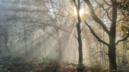
It was misty on 16 Nov 2019. Some of the photos are from a recce walk a few days before.
Click the Learn more button above to open the map in Outdooractive from where you can download the route to the free Outdooractive app for Android or iOS, or export the route to a GPX file for use in other apps. A GPX file for this route can also be downloaded from here. For more about using Outdooractive, and a list of all our routes with GPS files, see: GPS Routes
