Angus and Tracey Mills led this walk of around 9.8 miles (15.7km) starting from Abbey Fields Car Park in Kenilworth on Sat 12 Aug. There is a van in the car park serving coffee and cakes which is open from around 9am. Many in the group visited The Virgins & Castle, a nearby pub, for post-walk refreshment and lunch.
For parking fees, see the Car Park link above. When we visited it was possible to pay by card or in the RingGo app (location 23851) but not with cash.
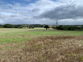
A route description, a map of the route and a link to a GPX file follow below the photo album.

Route description: From the car park, walk towards St Nicholas' Church, into the churchyard and follow the path ahead, bearing left to the remains of the monument. Pass through the archway and turn right following a tarmac path uphill to the road (High Street). Head downhill towards Kenilworth castle, bearing right, walking uphill with the castle on your left and crossing the road when possible picking up the Millennium Way at this point. Follow the Millennium Way for about 4km to Rudfyn Manor; the route winds thro gh arable farmland with various crops and lovely views; way markings are good to this point.
At Rudfyn Manor turn right along the tarmac drive walking about 100 metres to a road junction which joins from the right. Turn left here passing a solitary oak tree and crossing the field to the hedge boundary turning right following the field boundary for about 30 metres before reaching an opening in the hedge on the left. Continue along Millennium Way; after crossing a stile and passing through a metal gate Millennium Way takes a right turn; this turn is around 100 meters after the metal gate and is concealed and is easily missed if chatting. Continue ahead, crossing Kenilworth Road and continuing along the Millennium Way to Black Hales farm. The route leaves the Millennium Way at this point; way markings are not immediately obvious and the path is not perfectly aligned with the OS route on this stretch of the route.
At the entrance to the farm, pass through a metal gate. Millennium Way is marked here as is a minor path heading right on a diagonal which gets progressively more distant from the farm buildings. At the corner of the field there is a marker post. The route turns slightly to the right here; after a short distance there is a decision point about which side of the hedge to walk along. The OS map route suggests keeping the hedge on your left which is not the best option as the gate through the hedge at the end of this path is overgrown and impassible; instead, walk with the hedge on your right to a hedge gap at the end of the field. There is a well walked trail from this point which picks up the route again, heading downhill to the road (Hob Lane). Turn right walking along Hob Lane entering Burton Green and reaching 'The Greenway' on the right, the start of which has been recently redeveloped as part of HS2 works being clearly marked.
Follow the path which winds past a huge ugly/impressive (take your pick) tunnel that cuts across a previously walkable path to Black Waste Wood making it impassible. At the tunnel, head right along 'The Greenway', a disused railway line which is an 'easy walking' path used by runners, cyclists and walkers. After about 2km our route exits 'The Greenway' via a path on the right leading to Hollis Lane. Turn left, under 'The Greenway' walking along Blind Lane to a T junction with Crackley Lane, turning left at this point and heading uphill for about 200 metres to a junction on the right (Cryfield Grange Road). Take this turning and walk along Cryfield Grange Road for about 1.5km to Connect2 Kenilworth, a purpose-build, wide tarmac path connecting Warwick University campus with Kenilworth. Turn right here walking along the Connect2 path. HS2 works have disrupted this section of the route which has been diverted as a result. A good tarmac path has been laid and the route is obvious with a single decision point where the path forks left and right; take the left fork at this point skirting round the HS2 works ultimately rejoining 'The Greenway'. Upon reaching 'The Greenway' there is a tunnel ahead that passes under 'The Greenway' and a path on the left that leads up to 'The Greenway'; take the path and continue left along 'The Greenway' entering 'The Common'. Looking left at this point a railway bridge towers up above; turn right passing some benches made out of huge steel girders. A tree-covered path heads downhill before bearing right once more. After a short distance there is a path on the left; ignore this path continuing on a little further to another path on the left; take this second path crossing Finham Brook, ie a stream, to a residential street (Forge Road). At the T junction with Mill End look right for a further tarmac cycle route; head along this path which passes an allotment before reaching another road junction (Park Road); cross Park Road and continue ahead along the cycle path which follows the course of Finham Brook, eventually arriving at the A452. At this point, take the footpath alongside the brook which passes under the A452 into Abbey Fields; the car park is 50 metres from this point, uphill to the right.
Click the Learn more button above to open the map in Outdooractive from where you can download the route to the free Outdooractive App for Android or iOS, or export the route to a GPX file for use in other apps.
For more about using Outdooractive, a list of all our routes with GPS files, and a link to folder with all our GPX files including HHIK0095.gpx, the file for this route, see GPS Routes.
