This 10 mile walk was led by Angus & Tracey Mills from The Hatton Arms, CV35 7JJ on Saturday 17th July, 2021. A route description follows below, then some some photos and a map of the route with a link to a GPX file.
The route: walk through the pub grounds to the canal, cross at the brick bridge and continue straight ahead (walking away from the canal) to a wooden gate. The footpath continues ahead crossing the railway line over a bridge and passing Alders and Budbrooke farms where it becomes a track leading to a quiet road.
Continue along the road for 750m passing the entrance to Church Farm until you reach a small stream. The path is on the left immediately after the stream with the gate concealed behind a tree. After 500m the path kinks left then right passing through the hedge via a gate and continuing in the same direction to a minor road and then to a T-junction. Turn left at the T-Junction and follow the road for 75m to St Michael’s church. Walk through the churchyard keeping the church on your right to a gate at the rear of the graveyard. Bear right across a field to a metal gate and continue in the same direction across the next field to the corner to an archway that passes under the railway line. Continue right around the edge of the next field to a gate which enters the car park of Warwick Parkway station. Head across the cark park and out of the station following the road. Cross the canal via the road bridge looking for an entrance to the canal on your left; the route down to the canal is a little steep here. Join the canal and head east towards Warwick (under the road bridge that you have just crossed).
Continue along the canal for about 1.5 miles passing the Cape of Good Hope pub until you reach bridge 49 where you exit the canal. The next part of the walk passes along a busy road; rather than walking along the footpath there is a path that runs parallel with the road which is nicer. Upon reaching a roundabout, continue straight ahead; again it is possible to walk parallel to the road using minor roads in the neighbouring housing estate. After 500m turn left into Woodloes Lane crossing a bridge over the A46 before turning slightly left towards Woodloes Farm. Before reaching the farm turn right following the Millenium Way. Continue along Millenium Way for about 1.5 miles passing Wedgnock Rifle Range, through a wooded area (which can be quite muddy) and through a couple of fields. The route passes alongside Leek Wooton Golf course (on your right) before reaching a fairly distinctive mound of earth with route options to the right, left and straight ahead. Take the path to the left crossing a field to a track leading to Goodrest Farm. Turn left along this track towards the farm picking up the bridle way and continuing in the same direction past the farm with farm buildings on your left.
Continue straight along the bridle way until you reach a crossroads. Go straight over and continue straight ahead towards Turkey Farm and into Hatton Park housing estate. Continue straight ahead through Hatton Park following the footpath to the main road (A4117). Cross the road and continue ahead towards the canal along Middle Locks Lane. Upon reaching the canal bridge, turn right onto the canal. Continue along the canal passing Hatton Locks to arrive at the brick bridge that you crossed at the start of the walk. Turn right and head up the hill to the pub for a well earned pint/meal.
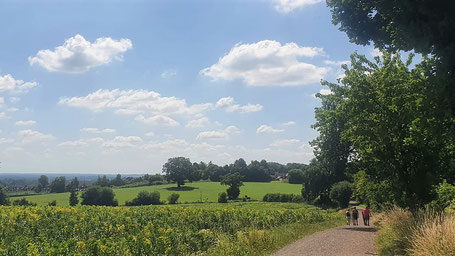
All photos by Mary Coles
Click the Learn more button above to open the map in Outdooractive from where you can download the route to the free Outdooractive app for Android or iOS, or export the route to a GPX file for use in other apps. A GPX file for this route can also be downloaded from here. For more about using Outdooractive, and a list of all our routes with GPS files, see: GPS Routes
