Our Hikes in 2019, with the most recent at the top
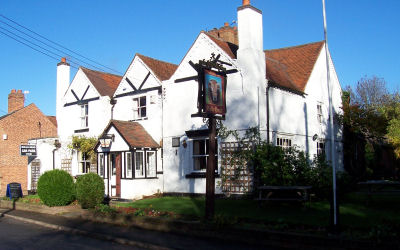
Alvecote Circuit
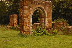
This 7 mile walk starts from the Samuel Barlow pub in Alvecote, B78 1AS. It passes the ruins of Alvecote Priory, Shuttington and the historic town of Polesworth then finishes along the towpath of the Coventry Canal. Most of the route is on tracks and roads to minimise mud.
A map of the route follows below the gallery of photos by Mary Coles.
A Walk from The Hatton Arms led by Angus & Tracey Mills
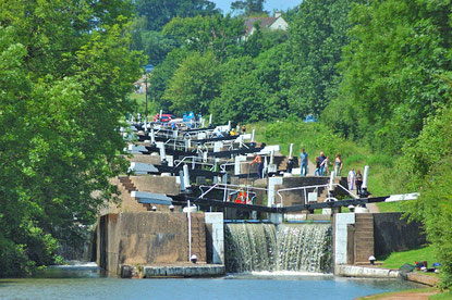
This walk from the Hatton Arms, CV35 7JJ, started at 9.00 am. It is a circular walk of about 10 miles, initially heading towards Warwick along the canal, leaving via a footpath by the locks at bridge 49, passing Woodloes Farm, skirting around Warwickshire Golf course and heading back to the Hatton Arms via Goldrest Farm, Bulloak Farm and Lower Farm. Easy walking predominantly; a mixture of canal towpaths, urban footpaths and bridleways.
A Walk in the Clent and Waseley Hills
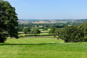
This walk of just over 9 miles starts and ends at the Walton Hill Car Park on Walton Hill Road in the Clent Hills. Our route goes through the Clent Hills before moving east to Waseley Hills Country Park and then looping back to the start and includes three principal summits: Walton Hill (316m), Windmill Hill (285m) and Clent Hill itself (309m).
A Walk from Hawkesbury Junction Led by Bob Reid
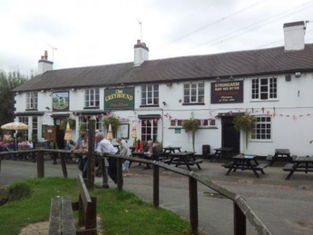
This walk starts from The Greyhound pub at Hawkesbury Junction, CV6 6DF, and is approximately 9.6 miles long.
The first 3 miles follows the towpath of the Oxford Canal east of Sutton Stop to Ansty from where it strikes north to the village of Barnacle continuing to Bulkington. From Bulkington the walk goes east to the Centenary Way which follows the Coventry Canal south back to the Greyhound pub.
A Walk from Claverdon Led by Angus & Tracey
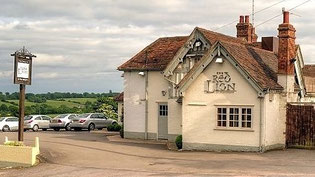
This walk starts from the Red Lion at Claverdon, CV35 8PE, at 9.30 am and is approximately 8.5 miles long. Car parking in the pub carpark, but please park on the gravelled or grass areas further from the pub.
The Red Lion serves lunches, chips and snacks.
A Walk from The Boot Inn led by Gill Shalley
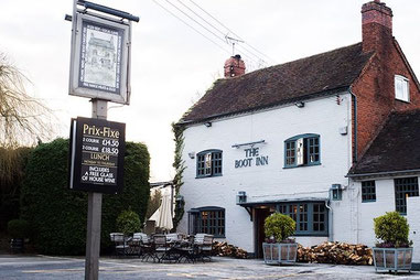
This walk led by Gill Shalley started from The Boot at Lapworth, B94 6JU, at 10.00 am on 6 Oct. The route was an 8 mile circuit taking in the canal towpath, fields and the grounds of Packwood House.
A Walk from Earlswood led by Bob Reid
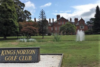
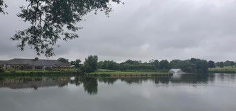
The walk started at the Red Lion, Lady Lane, Earlswood, B94 6AQ at 9:00am. We skirt the Lakes and head out alongside Clowes Wood heading north towards Becketts Farm, Wythall. From there we head west towards Weatheroak, circling the King Norton Golf Club we head past the cricket ground back towards Becketts Farm. We carefully cross the A435 and begin our return to the Lakes taking in views of the Fulford Heath golf club. We pass through New Fallings Coppice and return to the opposite side of the Lake to appreciate the view from that side. The walk is approx 9.5 miles long but can be reduced to 6 miles by stopping off at Becketts Farm for a leisurely coffee break and re-joining the walk as we pass back through on our return.
A walk from Bubbenhall led by Denis Pratt
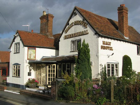
This walk starts from the Malt Shovel in Bubbenhall, CV8 3BW, at 9.30 am. It will be approximately 10.5 miles long.
From the Malt Shovel the walk proceeds north easterly along Centenary Way to Wolston from where it turns south through Knightlow Cross, the site of Britain's oldest known continual annual ceremony, the Wroth Silver ceremony. It continues through Stretton, with its links to Roman Britain and the Fosse Way, ancient Woodlands and finally back to Bubbenhall and the Malt Shovel.
A Walk from Portway led by Bob Reid
A circuit of around 7 1/2 miles from The Rose and Crown at Portway, B48 7JD, this walk is mainly across agricultural land, passing over the Hob Hill trig point, around Rowney Green and near to Newbourne Wood nature reserve before returning to the Rose and Crown. The walk has a few inclines, some quite long, but no steep climbs. Some parts are overgrown in summer so shorts are not recommended. On the way there are wonderful views across Worcestershire and on a good day the Malvern Hills are clearly visible.
A walk from The Griffin Inn, Shustoke led by Evan Grant

This walk of 8.7 miles (14 km) from the The Griffin Inn, Church Rd, Shustoke, Coleshill B46 2LB (Google Maps) through rural North Warwickshire follows a loop north to Foul End then back past the Shustoke Reservoirs to The Griffin. Some stretches are on quiet country roads but for the most part this walk is on footpaths through fields. When we walked this route, we left from the far end of the car park at The Griffin over a stile into the neighbouring field, then walked along the edge of the field, following the hedge beside the B4114. This short section is not marked as a footpath on the map, though had clearly used been used as one when we were there. The alternative is to leave the car park by the car entrance and walk down the B4114, but please take great care as the B4114 is a narrow, busy road with no pavement or footpath.
A Walk from Barston led by Gill Shalley
This walk will commence from The Bulls Head at Barston,
B92 0JU, at 10.00 am. and will be about 7 miles in length.
Hampton to Barston and back
A 5 mile walk from the Hampton-in-Arden sports club carpark to Barston via Barston Lakes and the West Midlands Golf Club and back via Walsal End.
Hampton - Walsal End - Grand Union - Barston - Hampton
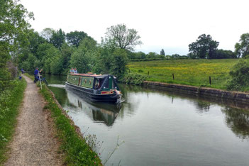
This walk of 8.5 miles (13.6 km) long follows the route shown on the map below; it leaves Hampton via footpaths to Walsal End and on past Henwood Hall Farm to the Grand Union Canal. The walk then follows the towpath to the bridge at Kixley Lane where it leaves the canal and crosses fields to Barston and on back to Hampton.
A Half Marathon Walk from the Gym
Check this route for disruption caused by HS2. Be prepared for detours for closed footpaths around the A452 and 16 Acre Wood.
11.5 mile "training walk" from the gym
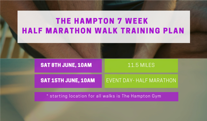
An 11.5 mile circuit let by Bob Reid around Hampton-in-Arden starting at 10am on Sat 8 June from The Hampton Health & Fitness Club. Enjoy this as a walk in its own right, or as the last of the "training walks" organised in preparation for the Half Marathon Walk in support of Cameron Grant Memorial Trust on 15 June. If you would like to make a donation, please do so on this page at TotalGiving.
A 10 mile circuit from Hampton-in-Arden
Check this route for disruption caused by M42 J6 improvement work. Be prepared for detours for closed footpaths around Catherine-de-Barnes Lane.
A Hike from Hampton led by Angus & Tracey Mills
Check this route for disruption caused by M42 J6 improvement work. Be prepared for detours for closed footpaths around Catherine-de-Barnes Lane.
A Walk from Hampton-in-Arden led by Gill Shalley
This walk starts at The Beeches Car Park in Hampton-in-Arden and makes its way to Barston then returns to Hampton via the Grand Union Canal and Walsal End.
A 17 mile circuit around Balsall Common
This route needs to be updated to accommodate HS2 diversions. Be prepared to follow diversions! Thanks.
A Hike from Meriden led by Sharron Maguire

This walk starts from the Queens Head at Meriden, CV7 7JP, will be led by Sharron Maguire and start at 9.00 am. It will be approximately 9 miles long .
The walk takes in some lovely views and is through fields, farmland and woods with a stop at the tree under which John Wesley preached. It heads east towards Eaves Green and then Harvest Hill and turns northwards towards Corley Moor. Skirting Birchley Hayes Wood it comes to John Wesley's tree. From there it returns to the Queen's Head for a well earned drink.
Aston Cantlow - Alcester circuit

A 14 mile hike from The King’s Head in Aston Cantlow through Little Alne, Alcester, Little Britain, Red Hill and back to Aston Cantlow, this route follows sections of The Monarch's Way and The Arden Way and takes walkers through some of the finest landscape in Warwickshire.
A Hike from Wootton Wawen led by Gill Shalley
This walk will start from The Navigation Inn, Wootton Wawen, B95 6BZ, at 10.00 am on Sat 23 Mar and will be led by Gill Shalley.
The walk will be 8 or 9 miles long and will take in a length of the Stratford Canal, Austy Wood and the peaceful villages of Bearley and Langley.
There is parking at The Navigation Inn for customers, so parkers will need to eat and/or drink.
Please let Gill know direct or via hampton.walking@gmail.com if you intend to join the walk.
A Hike from Brandon led by Mary Coles
An 8 mile circuit starting from the Royal Oak, Brandon, Coventry, CV8 3HR. The walk passes through Wolston, Church Lawford, Kings Newnham and Bretford before returning to Brandon. There are some very pretty villages and glorious open views. There are also quite a few stiles in the first half of the walk, and many are not dog-friendly. Car parking is available at the pub if you're drinking there after the walk. Please use car park opposite pub rather than the one next to it.
3 Ways Round Berkswell
Some parts of this route from 2019 will need to be modified because of HS2 work
Hike from Burton Green led by Sharron Maguire
Some parts of this walk may need to be modified because of HS2 work
A hike from Hatton led by Angus & Tracey

There will be a hike starting from the Hatton Arms,CV35 7JJ, starting at 9.30 am.
This is a shorter variant of the Hatton Walk that we have done previously, approximately 9 miles long. Easy walking mainly on bridleways, pavements, metalled tracks / minor roads and good canal towpaths with minimal mud: a banker for this time of year.
A New Years Day walk from Henley in Arden
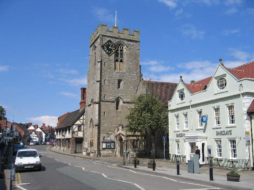
This hike was led by Bob Reid from the Prince Harry Road Car Park in Henley-in-Arden (Set Sat Nav for 1 Fieldhouse Cl, Henley-in-Arden B95 5DF). The walk took us just under 3 1/2 hours.
This route is just under 8.5 miles long and is mainly along tracks and country lanes. Some of the walk gets muddy after heavy rain.
