Our Hikes in 2016, with the most recent at the top
A Walk from Warwick University to Abbey Fields in Kenilworth
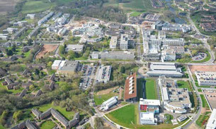
This walk starts from car park 12, Kirby Corner Road, Warwick University, CV4 8UW. On leaving the car park onto Kirby Corner Road turn right and walk along the road towards the university entrance, at the roundabout turn left along Gibbet Hill Road, on reaching the next roundabout turn right and walk through a large group of student lodgings with a lake on the left. At the back of the lodgings keep left and make for Cryfield House, just past this look for a signed footpath on the right and take it. Follow this footpath/cycle track until a narrow footbridge with a distinct uphill angle on the right is reached, cross the footbridge into a field and turn left walking along the edge of the field with a hedge on the close left. Follow the hedge to a gate leading onto a lane, cross the lane and proceed down a footpath/cycle track with frequent cattle grids and bridle gates. At the end of the track, go through a narrow tunnel under a disused railway and follow the footpath to the Coventry Road, on reaching the Coventry Road do a hairpin turn to the left and proceed along a track which leads up to the Greenway, a disused railway.
Walk from The Navigation at Lapworth
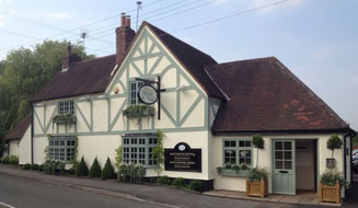
Kay Dick led this walk of around 10 miles from The Navigation at Lapworth, Old Warwick Road, Lapworth, Solihull, B94 6NA - a family run, traditional country pub with a passion for great beer and food!
From the pub car park turn left along the road. Turn left following Heart of England Way down a drive and through a gate, into a stable yard. Go through the yard and paddocks. Continue through fields towards Baddesley Clinton. Cross the road, taking the path on the left, through a wooded area to Bromes Park. At the road, turn left until a junction, keep right, then cross the road.
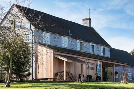
Walk from the Hatton Arms led by Angus Mills

Distance: around 10.5 miles starting at the Hatton Arms, Birmingham Road, Hatton, Warwickshire, CV35 7JJ.
From the pub we cross the Birmingham Road and head West (left) for a short distance before turning right and walking up the drive to Home Farm. We take a footpath on the right and circle around the farm buildings before turning right onto a track on the other side of the farm; we head away from the farm (right) and then turn right and continue straight to a minor road.
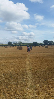
A Circular Hike from Ansley thro' Old Arley, Birchley Heath, Ansley Common and back to Ansley

The walk starts from The Lord Nelson Inn, CV10 9PQ; the pub carpark is not available for parking without prior permission but there is ample street parking in Nuthurst Crescent adjacent to the pub.
From the Lord Nelson turn right down the main road on the LHS, at the Ansley Fish Bar turn left onto a narrow footpath which bends to the left behind the fish bar. Follow this enclosed path through a gate and then turn right and continue to follow the footpath beside a fence which leads to a gate opening onto a golf course. Bear to the right across the golf course heading to the right of a group trees and to the left of a bunker taking care to avoid golfers teeing off, continue right across the golf course making for the far right corner. In the corner turn right by a large bunker into a wooded area, looking for a gate on the left, go through the gate and across a footbridge through the trees, turn right. Follow the path with the trees on the right through a gate and continue following the path with the hedge on the right. Keep following the path into Old Arley, turn left along the Ansley Lane to the pub "A Wagon Load of Lime", just past the pub, turn right along a lane which leads into a field. When reaching Arley Wood bear right along the edge of the wood and keep following the edge of the wood through a gate, when the wood edge turns left follow it through a gate keeping the wood on the left, but at the end of the wood continue straight on across a cultivated field to a gate leading to a lane.
Walk from Newbold Comyn Arms, Leamington Spa
A walk of around 8 miles in rolling Warwickshire countryside starting and ending at The Newbold Comyn Arms, Newbold Terrace East, Leamington Spa, CV32 4EU
From the pub car park we will walk east down Newbold Terrace East until we arrive at a play park on the right and a couple of car parks opposite. We head left through the car parks joining a tree lined footpath which is a continuation of Greenwood Court and which runs alongside the Golf Course. We turn right (East) along this path until we pick up signs for the Millennium Way on our left. Turning left we cross the Golf course heading broadly North along the Millennium Way towards Cubbington. Contrary to the OS Map the route across the Golf Course is at 90 degrees to the path that we are leaving and does not go diagonally to the right: there is no signage at this point but it appears again after crossing the Golf Course and is good from this point. We follow the Millennium Way passing Redhouse Farm before we skirt around a wooded area ('The Runghills') and on towards Glebe Farm. Just before Glebe Farm the path ahead starts to climb and there is a gate on the right which is easy to miss. We don’t climb the slope and instead pass through the metal gate on the right, taking the path that continues in the same direction passing directly through Glebe Farm and continuing North towards Cubbington ...
Walk from The Bulls Head at Barston
This walk starts from The Bulls Head at Barston. There is a car park at the pub , post code is B92 0JU or you can park in the church car park. The walk is around 8-9 miles.
Starting from The Bull, turn left along the road until you come to St Swithin's Church. Which will be on your right. Go through the church gate and walk to the far right corner where you will find the footpath. Then take the next gate on the right following along the side of the fence. Then going through the next gates past the Alpaca's and sheep in their small paddocks. Through two fields until you come to the road. Cross the road where you will find two footpaths, take the footpath on your left. Take the foot bridge across the river. Walking through two fields until you get to Nappins Covert. Take the footpath towards Knowle across the fields until you get to the Canal. Turn left taking the canal path, passing by Knowle Locks, The King's Arms until you get to The Black Boy pub on your left.
Loop from Abbey Fields, Kenilworth to Burton Green and back
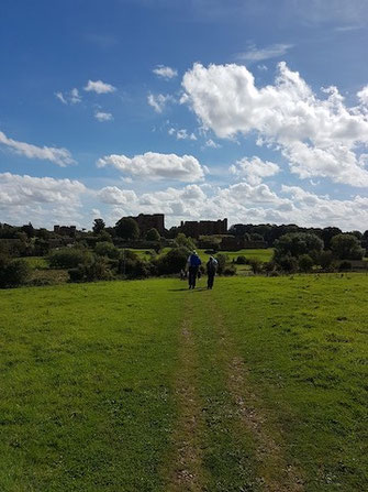
This walk starts from Abbey Fields Car Park (free on Sundays), Bridge St, Kenilworth, CV8 1BP and is just over 8 1/2 miles. See below for a map and see this album for more photos from the route.
Leave the carpark onto Bridge St. and turn left towards the traffic lights, at the T/L's turn right up New St.. When the main road forks to the left, keep right into Manor Rd., cross to the LHS of Manor Rd. and continue over a bridge past some allotments on the left, then turn left down a cycle track with a hedge between the track and the allotments. At the end of the cycle track turn left into Forge Road opposite The Old Engine public house.
At the end of Forge Rd. take a footbridge on the right over a stream into a wooded area, at a junction of tracks turn right along a cycle track, just before going under a railway bridge turn left through some metal barriers along a cycle track which climbs up. At the top follow the track alongside the railway for a short distance; continue along the track when it leaves the railway and eventually reaches a new footbridge across the main Coventry Road. Go over the footbridge to "The Greenway", a disused railway.
Proceed along the Greenway, and just past the first bridge over it, take a path on the RHS which goes up the embankment back to the top of the bridge. Go through a gate at the top of the path and turn left down a short piece of track to a gate into a field. Follow the footpath along the side of the field with a hedge close on the left into the next field and continue to a road, cross the road through a gate onto a narrow overgrown path.
Circular Walk from Henley-in-Arden along the Arden Way to Morton Bagot and back via Heart of England Way
This walk starts outside the The White Swan Hotel, 100 High Street, Henley-in-Arden, B95 5BY. The nearest free car park is on The Croft, B95 5DY, just off the High Street. See below for a map and photos from the route.
From the White Swan proceed north along the High St. and turn left into Station Road, after about 100 yards bear right along Bear Lane. Directly after going under a railway bridge look for a gate at the top of a stepped bank on the right and go through it to a footpath running parallel to the railway on the right. this is the Arden Way, follow this path to where it turns left on a golf course, pass in front of the golf club and go half right to a sign post. Follow the Arden Way waymarks to the right and proceed along a bridleway with a hedge on the left, when you come to a lake turn left to keep the lake on the right, when you leave the lake keep ahead, following the Arden Way round to the right, over a stile and half left to a gate leading to a farmyard. Cross the farmyard to a road.
Turn left along the road for 1/4 mile then look for a green track on the left (still the Arden Way) at the edge of a wood, follow the track to the end of the wood and then turn right along a road. 250 yards along the road turn left over a stile onto a footpath with a hedge on the left, after some 300 yards the path goes through the hedge and leads into a churchyard. Go ahead through the churchyard around a tree on the right and exit through a gate onto a tarmacked track. The track leads onto a road, turn left along the road and continue to a T-junction. At the T-junction go straight ahead through a gate and follow the path diagonally across a field to a gate in the hedge, down a bank and across a lane into another field via a stile.
Circular Walk from Hampton via Barston and Balsall Common
The walk starts at the gym by going down Old Station Road towards Hampton village, at the end turn right along Meriden Road passing over the railway bridge, cross over the road and continue to the sharp right hand bend and there turn left down Belle Vue Terrace. At the end of Belle Vue Terrace take a short enclosed footpath on the right which leads to a metal gate on the left, go through the gate and, keeping a hedge on the left, proceed along the side of the rough pasture to the end. Here, pass through two gates within 10 yards and keep ahead along the next field still with the hedge on the left, maintain direction across a footbridge into the next field and continue until a farm track is reached, cross over the track and follow a footpath slightly to the left across the middle of a cultivated field. Passing through a gap in the hedge enter a field and make for a gap in the fence on the right, go through the gap and turn left onto a lane.
Hampton to Solihull and back
This walk is not currently accessible because of M42 J6 improvement work and will need to be modified when the work is complete to follow new footpaths. Evan Grant, 6 Feb 2022
A Circular Walk from Whitacre Heath via Kingsbury Water Park

This walk is approximately 9.3 miles and starts from the carpark of The Swan Inn, Whitacre Heath, B46 2JA. It starts by following the Heart of England Way to Kingsbury Water Park and then following the Centenary Way back to Whitacre Heath.
From the carpark turn right to a T-Junction at which turn right again and follow the road for 1/4 mile where a road joins from the right, opposite the road there is a gate in the hedge signed HoE Way, go through the gate and across the middle of a cultivated field to a stile in the hedge, go over the stile and across the middle of a second cultivated field to a gate in the hedge leading onto a lane. Cross the lane onto a track passing several attractive houses, follow the signed bridleway ahead, going through a gate and continue through an avenue of trees to reach a gate into a field. go diagonally across this field aiming well to the right of a barn. At the far side of the field follow the HoE Way waymark gently uphill to reach a road at Foul End.
Circuit from The Boot, Lapworth
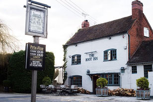
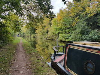
An 8 mile loop from The Boot, Lapworth through local countryside along footpaths, canal towpaths and, on occasion, minor roads. Begin from the car park at The Boot, Old Warwick Rd, Lapworth, Solihull, Warwickshire B94 6JU. This loop gives a great opportunity to experience something of the local heritage in lovely countryside on an 8 mile route which follows the Stratford Canal, the Grand Union Canal and passes through the grounds of Packwood House first constructed as a farm house in the 1550’s. You may even catch a glance of the famous Yew Garden containing over 100 trees laid out in the mid-17th century.
Hatton circuits
Angus and Tracey Mills planned this walk for the Hampton Hikers with two options - a 'standard' Hampton Hikers walk of around 11 miles and an 'extended' walk of 17+ miles for those who are in training for the Cotswold Way Walk (or anyone else wishing to join them).
Henley-in-Arden loop towards Shelfield and back

This Hike of just over 9 miles in the countryside surrounding Henley-in-Arden has only one steep hill. It begins and ends at The Prince Harry free car park (B95 5DD).
From the car park walk into the centre of Henley-in-Arden and up the high street towards the Train station. Going west take the footbridge over the railway line and join the Heart of England Way.
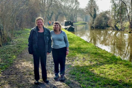
Lowsonford circuit to Austy Wood and back
Circuit from the Fleur de Lys, Lowsonford through the parish of Preston Bagot & along the Stratford Canal to join the Monarch's Way. Then through Tattle Bank, Yarningale Common & back along the Stratford Canal to the Fleur de Lys. We completed this walk in glorious spring weather on Sun 13 March, and sat outside for a drink at the Fleur de Lys afterwards. See below for a map of the route.
Hockley Heath Circular Walk via Packwood House and Stratford Canal
Walk Description: this walk is approximately 8.5 miles, the elevation varies by some 25 metres with no steep gradients. The walk starts at the Barn Motel on the A3400 (B94 6NX) where there is free car parking.
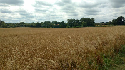
The walk starts by crossing the A3400 and proceeding down a waymarked track directly opposite the Barn. The track leads to a kissing gate from which a footpath runs through a band of trees, this path bends right into an open field. After some 250 yards turn right down a waymarked footpath which goes across five cultivated fields for about 1/2 mile to a stile in a hedge. Turn half left and proceed diagonally across a meadow to a road. At the road turn left and after 50 yards turn right up a waymarked track, at the end of the track turn left and skirt round three sides of a field keeping the hedge on your left until you see a stile in the hedge on your left. Cross the stile and proceed to a drive past houses to a road.
