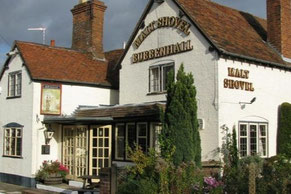
Sharron and Pete Maguire led a hike of just under 8 miles (12 1/2 km) from The Malt Shovel, Lower End, Bubbenhall, CV8 3BW (link to The Malt Shovel in Google Maps) on Sunday 10th August.
The walk started by skirting Warwickshire Lavender Farm in Bubbenhall before heading across fields towards the picturesque villages of Weston Under Wetherley, Hunningham and Wappenbury then returning to Bubbenhall through a wooded area.
See below for a photo album from the walk, a map of the route and a Google Map showing The Malt Shovel.
Click the Learn more button above to open the map in Outdooractive from where you can download the route to the free Outdooractive App for Android or iOS, or export the route to a GPX file for use in other apps.
For more about using Outdooractive, a list of all our routes with GPS files, and a link to folder with all our GPX files including HHIK0139.gpx, the file for this route, see GPS Routes.
