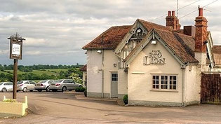
This walk starts from the Red Lion at Claverdon, CV35 8PE, at 9.30 am and is approximately 8.5 miles long. Car parking in the pub carpark, but please park on the gravelled or grass areas further from the pub.
The Red Lion serves lunches, chips and snacks.
A map of the route follows below the route description and the photos.
Route:
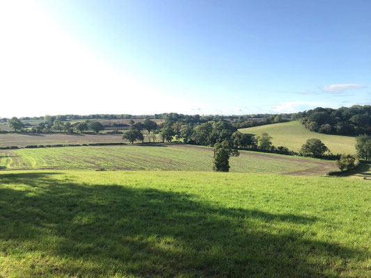
After leaving the Red Lion, head uphill for a short distance before turning left into Church Road. Continue along Church Road looking for the entrance to Park Farm on the left (there is no footpath sign at this point). Walk along the farm drive a short distance to a five bar gate across the road. Either side of the gate there is the entrance to a footpath. Take the path on the right. After a short distance the path merges with a track at a pond. Beware missing finger post. Turn left at this point off what feels to be the more major path. Continue ahead, crossing the railway line before reaching a road. At this point the obvious path is straight ahead, however, in order to avoid a densely packed field of cows with calves we turn right here walking along the road to another path on the left. The route skirts the edge of Wolverton where there are some beautiful views of the Warwickshire countryside, a pretty church and also some great damsons (if making damson gin or damson jam this year bring a bag or container). From Wolverton head back towards Langley, crossing the road and the railway line once more before picking up Monarch’s Way (look out for the phone box in Langley). Monarch’s Way is a bit muddy at this point; signage is also a surprisingly poor for a national trail and the path deviates a little from the map at one point but no real problem finding your way to Cutler’s Farm. Turn left passing through the farm yard and up “Mary’s Hill” towards Austy Wood. On entering the wood turn right and head downhill towards the canal. The path is quite wet and there is some mud here but, on the recce, it was a great deal better than I expected after the rain that we had had. Cross the Stratford and Avon canal at Green Lane Bridge and continue ahead reaching Pettiford Lane. Turn right and then almost immediately right again down a tarmac lane leading back towards the canal to a bridge. Cross the bridge and look for a stile immediately on the left, cross it and take the path that runs parallel with the canal. The path is not well trodden. Head along the path for around 1km at which point there is a bridge over the canal (the path cuts back on itself so there is no need to continue all the way to the canal bridge). Turn right, heading towards Cherry Pool Farm, skirting around the farm and arriving at Kington Lane. Turn right at the road walking along Kington Lane for around 500m looking for a path on the left which enters a small enclosure before crossing a style into an open field with quite a slope upwards (sorry, people: a bit tough but we are nearly done); the entrance to the path is well concealed behind a tree and is easily missed. Head up the hill on a slight diagonal left. At the top of the hill enter and cross another field to a stile which leads to a road. Turn left walking a short way along the road to a footpath on the left. Take the path and continue ahead until reaching a T-junction with a bridleway. Turn right, passing Claverdon Primary School before reaching Langley Road. Turn left along this residential street before turning right into St Michael’s Road for a great view of the church. Continue ahead through the churchyard and on to Church Road once more, turning left here and then right at the junction to arrive back at the Red Lion.