Some parts of this walk may need to be modified because of HS2 work
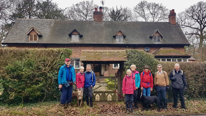
This hike, led by Sharron, will be 8 miles in length and start from the Hickory Smokehouse (formerly the Peeping Tom), Cromwell Lane, Burton Green, CV4-8AN, at 9.30am.
The route covers a delightful area of the Warwickshire countryside including farmland, some woodland and quiet lanes. The walk incorporates a section of the Millennium Way, where you will be guided by the distinctive black waymarkers.
The route has several gentle gradients throughout. You will need to negotiate lots of kissing gates, footbridges (including single plank bridges), some steps, plus 12 stiles (some of which dogs will need a lift over). There are a couple of road crossings plus some short sections of road walking. You may come across livestock in some of the fields. Allow 3.5 hours.
Some photos and a route description follow; for a map and a link to a GPX file for the route, please see the bottom of this page.

With your back to the pub, cross over the road and go left for a few yards to find a footpath on your right. Go down this narrow track (with a fence on your left) and follow to the end of the track into a field. Continue along between wire fences and, on reaching a corner, continue right along the narrow track to go through a kissing gate at the end of the track, and take a kissing gate a few yards ahead into a field. A lovely panoramic view unfolds ahead.
Stay forward, gently down the field keeping a hedge on your right. After some 150 yards, there is a prominent waymarker post pointing to a hedge gap on the right. Go through this gap then go left through a kissing gate into a field. Turn right, keeping the hedge on your right. Stay along the edge of this large field, keeping the hedge on your right. At the field corner, take a kissing gate into the next field and go diagonally right, aiming towards a far solitary waypost, then continue on to the field corner to reach another yellow-topped waypost.
Take the footbridge over a ditch then stay ahead (with the hedge on your right) to take a kissing gate into the next field. Continue forward, keeping the wood on your right. At the field corner, go through a kissing gate and take the steps up to a disused railway line. Cross over and take further steps down into a woodland then cross a plank bridge over a ditch into a large field. Turn right here and continue along the field edge with trees on your right. On reaching the road via a wide gated gap, cross over and go right to reach a T-junction.
Turn left here into Hob Lane and continue on past Burton Green Primary School. After a further 200 yards or so, where the road bends gently right, go left by the waymark sign, following the route named Birmingham Road. (Ignore the footpath on the right). Stay along the private drive and, just before a white house named Stile End, take a stile/gap on the left and then a kissing gate into a field. Stay directly forward here, taking the right-hand footpath and keeping close to trees on your right.
Take a kissing gate in the field corner and stay on the same the heading to reach the field corner. Take the stile here into the next field then go diagonally left across the field. Keep going diagonally across this very large field, aiming in the distance for the gap between the second and third pylons from the left. Eventfully you will reach a gated footbridge, approx 80 yards in from the left field corner. Take the double-gated footbridge, then go left to pass double power poles through a gap into another field. Continue along the line of the power lines, with a hedge on your right to take a kissing gate to the main road.
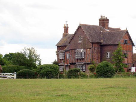
Cross directly the over the main road and continue up the driveway of Rudfyn Manor (pictured, and once a hunting lodge on the castle estate), signed Meer End 1 mile. Just a few yards after passing a large pylon on the left and passing under power lines, you will reach a driveway on your left. Here we have reached the point where we join The Millennium Way.
Opposite this driveway we turn directly right to cross a field, passing 10 yards to the left of a large solitary oak tree. Stay ahead across the field centre, aiming for a yellow-topped waypost by the field corner edge, where you will notice a distinctive black Millennium Way waymarker. Follow the waymarker slightly right then, after 10 paces, take the gap on your left and turn immediately right to stay along the field with a hedge on your right. Follow around the field edge, heading up the field to reach a far mid-hedge stile.
Take this stile and go over a ditch bridge and a second stile. Go across the centre of the next field to the far-right corner to find a waymarker and kissing gates. Take both kissing gates and go ahead, with a hedge on your right, to find and take a metal kissing gate on your right. Go ahead over the field centre of and take a gateway to the main road.
Cross over main road and turn left, then almost immediately turn right over a stile into a tree-lined copse to reach a field. Continue with the hedge on your left then take a corner kissing gate and go right, hugging two sides of the field to reach the far corner stile. Cross the stile and ditch bridge, then go diagonally left across the field to a hedge gap by a large oak tree, then ahead to find a field corner gate. Take this gate and cross the ditch bridge to a driveway.
Cross the driveway and take a kissing gate to the left of the gateway. Go left, with a hedge on your left, to find and take a field corner stile. Go right with a hedge on your right to exit via a field gap. After the gap, go left (with a hedge on your left) to reach the field corner. Remain in the field and go right (with hedge still on your left), passing under power lines to find a field corner ditch bridge. Take the ditch bridge and continue with the hedge on your left to take the stile to the road.
Go left along the road for some 500 yards, then turn right into Camp Farm/Pheasant Oak Farm. Go up the driveway of the farm, through a gateway and up the centre between buildings to find large kissing gate (this is sometimes obscured by the parked caravans) in the very far left corner. (NOTE: You will have to negotiate your way through the stored caravans to reach the kissing gate.) Take the kissing gate, go ahead over a field to continue with a hedge on your left and then take a stile to the road, Waste Lane.
Cross the road and go right for 30 paces to take a large kissing on your left to enter a field. Go diagonally right over the field to exit by the corner kissing gate to a road. Go right on Old Waste Lane then take the driveway left, adjacent to a house named Oaklands (some 40 paces before the road end). After 70 paces, continue through a passageway to reach and take a kissing gate into a field. Go with the hedge on your left to reach the corner, then go through a metal kissing gate and over a ditch bridge to maintain your line (with a hedge on your left) to reach a hedge and kissing gate.
Take the kissing gate and continue with the hedge on your left to reach the corner field kissing gate. Take the gate and steps up to the disused railway, go slightly right then immediately left, taking the steps down to take a kissing gate into a short land strip and cross a ditch bridge. Go with the hedge on your left to take a bridge then a kissing gate. Go ahead under power lines to take the corner kissing gate then continue ahead to a rough driveway. Follow around right and, after some 50 paces, take the kissing gate on your right and go left across the field to a mid-fence latch-gate. Take the latch gate and continue ahead to the field corner, emerging onto a drive via another latch gate. Turn right along the driveway to reach the road.
Here we leave The Millennium Way and turn right along the road, eventually to reach a crossroads after some 500 yards. Continue ahead over the crossroads (signed Burton Green) and, after a further 100 yards, find a kissing gate on the left. Take this kissing gate and follow the direction of the waymark, past a solitary tree ahead, to the right of a mound. After the tree, aim for the left fence corner where there is a waymark directing you to the field corner kissing gate. Take the kissing gate then stay ahead, very gently uphill keeping a wire fence on your right, to reach two large metal gates ahead.
Take the corner stile adjacent to the large gate on your left into a field. Walk ahead, more or less parallel to the power lines, for 200 yards to reach a waymark post. Here we need to turn right (there is a waymarker on the wooden pen) and pass up the field between the wooden pen on your left and a lone tree on your right. Keep ahead across the field, aiming for the exit kissing gate (just to the right of the house directly ahead). Take the kissing gate and stay along the driveway past houses to reach a road. Turn right along the road and shortly you will arrive back at your starting point.
Click the Learn more button above to open the map in Outdooractive from where you can download the route to the free Outdooractive app for Android or iOS, or export the route to a GPX file for use in other apps. A GPX file for this route can also be downloaded from here. For more about using Outdooractive, and a list of all our routes with GPS files, see: GPS Routes
