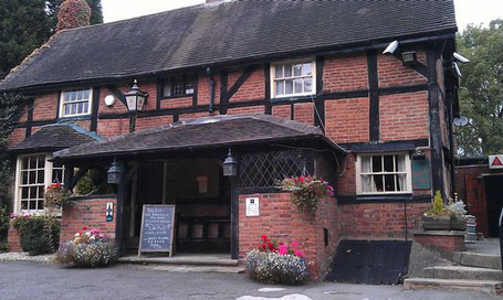
This walk begins from The Brickmakers Arms, Berkswell, CV7 7EG. Cars may be parked at the pub or in the nearby station car park, CV7 7EF. The walk is just under 9 miles long with no steep inclines.
It is a rural walk through agricultural land and proceeds from The Brickmakers Arms through Barratt's Lane Farm, Beechwood, Carol Green, Benton Green to Berkswell village. From the village it follows the Heart of England Way to Balsall Street and then winds back past Grange Farm and through Balsall Common to The Brickmakers Arms.
A route description follows; for a map and a link to a GPX file for the route, please see the bottom of this page.
Description.
From the car park of the Brickmakers Arms, cross the road and turn left down the hill towards the station, Immediately past the car showroom turn right and find a gate to a footpath, go through the gate. (Do not go up the road to the station car park). Follow the footpath straight ahead through 3 fields and over 2 footbridges always keeping the fence and hedges to the right. At a gate in the hedge towards the end of the 3rd. field go through the gate and immediately turn left so maintaining direction with the hedge close on the left. Keep along the hedge through 4 fields and turn left through a gate in the far corner of the 4th. field, proceed along a narrow path which bends right and comes out onto a road. Keep ahead, ignoring the footpath signpost pointing to the left, and walk in front of a row of houses until a footpath finger post is seen on the RHS of the road pointing left, follow the sign down a track which leads to a meadow. Continue through 3 meadows with the hedge close on the left, after the third meadow go through a gate and up some steps to cross the Greenway (a disused railway track) and then down some steps immediately opposite and through a gate onto a path running along the LHS of another meadow which leads to a cinder track. Keep left and follow the cinder track which goes round a right hand bend and then runs parallel to the railway.
This track runs into a road, turn left along the road, Hodgetts Lane, over the railway and continue to a T-junction with Truggist Lane, turn right fora short distance to another T-junction with Spencers Lane. Cross Spencers Lane and look for a footpath signed just to the left of a house, turn right onto a track and proceed across 3 fields with a footbridge at the end of the third one, go over the footbridge into a 4th. field and at a cross path turn left. Maintain this new direction through a gate into a meadow with the hedge close on the right and continue this way till the end of a 2nd. meadow where there is a gate in the far right corner. Go through the gate and follow the Coventry Way signs ahead with the hedge close on the right, maintain this direction with a right/left wiggle over a footbridge through the hedge in the middle until a road is reached.
At the road turn right to a T-junction with Benton Green Lane, turn left along Benton Green Lane to a T-junction with Broad lane, turn right along Broad Lane for about 50 yds. then turn left on to a drive to Hill House Farm (signed). At the bottom of the drive go through a gate on the left into a meadow and proceed down the left side of 4 fields to a farm driveway. Head down the driveway past a lovely old farmhouse for some 1/2 mile to Meriden Road. Turn left along Meriden Road looking for a footpath sign on the RHS of the road pointing right, this is shortly after the 30 MPH signs for Berkswell village. Follow this footpath which leads through Berkswell church yard to a road in front of the church, turn right on the road and go past the front of the church, through a gate into a group of trees and thence onto a board walk beside a stream with Berkswell Hall to the right. At the end of the board walk go through a group of trees and then maintain direction along the RHS of a cultivated field with the hedge close on the right. At the end of the field go through another group of trees to a road (Park Lane), turn right on Park Lane to the dual carriageway, A452, cross the A452 and turn left towards Balsall Common. After crossing the railway turn right down Wootton Lane and then immediately left along Wootton Green Lane, follow the road to a left hand bend and go straight on along the drive to Wootton Grange. At a right hand bend in the drive go straight on over a style into a meadow, turn right keeping the hedge on the right, at the corner of the field turn left downhill along the right edge of the field to a style into a group of trees, go over the style, across a footbridge and proceed straight ahead up the hill.
At the end of the field go straight ahead downhill to a style leading into another field, go across this field crossing a footbridge in the centre of the field, through a hedge and proceed along the RHS of 2 further fields to a road, Balsall Street, cross the road and turn left towards the Saracens Head pub. Opposite the pub look for a footpath on the LHS of the road, take the footpath and follow it into the next field, here take the right hand path at a fork in the footpaths, this leads to the right hand corner of the field. Through the hedge, turn right and follow the path to the back of somr houses, here turn left and then follow the path across the centre of the field to a gate in the far hedge. Through the gate turn right to the corner of the field, cross a footbridge to a farm drive, cross the drive inti a cultivated field. Here turn left for a short way to the corner of the field and then turn right go ahead along the edge of the field with the hedge on the left. Towards the end of the field go through a gap in the hedge and maintain direction along the footpath with the hedge now on the right to a track through a copse. This track leads onto a drive passing in front of a small group of houses to a main road, A452, cross the road to Lavender Hall Lane, some 100 yds. along the road go into the recreation ground on the right. Follow the tarmac path to the right and take the left fork in the next field keeping Katherine's Wood close on the left. At the end of this path go through a wooden fence into a housing estate.
Go ahead to the end of the road and turn right and then right again onto Riddings Hill, after about 100 yds. take the first road on the left and then the first road on the right to an alley way which leads onto Station Road. Here turn left down the hill to the Brickmakers Arms.
Click the Learn more button above to open the map in Outdooractive from where you can download the route to the free Outdooractive app for Android or iOS, or export the route to a GPX file for use in other apps. A GPX file for this route can also be downloaded from here. For more about using Outdooractive, and a list of all our routes with GPS files, see: GPS Routes
