
This walk starts from The Lord Nelson Inn, Birmingham Road, Ansley, Nuneaton, Warwickshire CV10 9PQ (Google Maps). Please note that the pub requests that walkers do not use their car park, but there is plenty of roadside car parking nearby (eg, in Nuthurst Crescent). The walk includes visits to The Sperrin Brewery at the Lord Nelson and to the Church End Brewery. Detailed route guidance follows below the photo gallery.
Route Guidance
Head away from the Lord Nelson Inn along Nuthurst Crescent to a T-Junction; turn right and walk 20 yards or so along the road looking for a footpath on the left. Cross the road, passing through a metal gate and continue across a grassy field heading on diagonal to the right. At the bottom of the hill are two metal gates; take the rightmost of these.
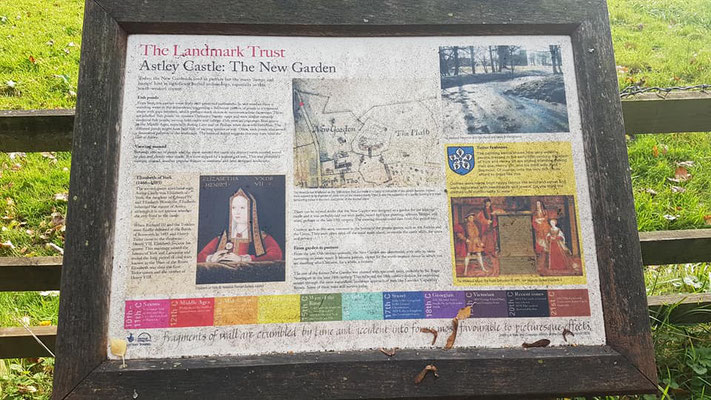
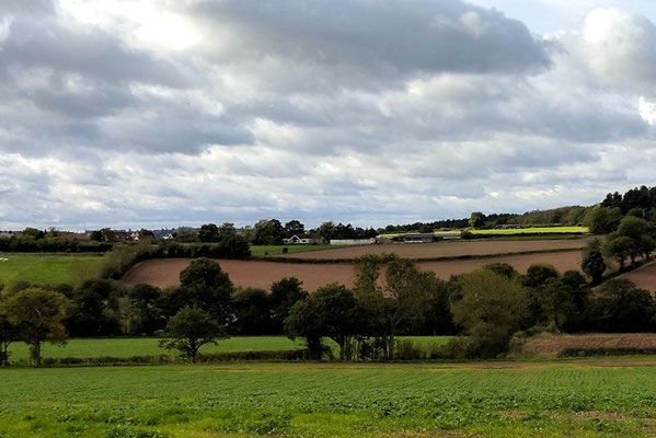
Continue along the path for a short distance until you come to the first hedge boundary; turn right and walk along the hedge boundary keeping the hedge boundary on your left (there is no sign to indicate this turn). A few hundred metres later the path passes left through the hedge; 20 metres or so later there is a wide opening on the right into another field; turn right here leaving the Centenary Way (again signage is poor) passing through this opening and continuing ahead along the leftmost field boundary to a road. Cross the road and continue ahead following signage and passing by Lady Wood and Lodge Farm before arriving at Astley Castle, which looks like a ruin but is in fact a wonderful renovation project: www.landmarktrust.org.uk/search-and-book/properties/astley-castle-4806
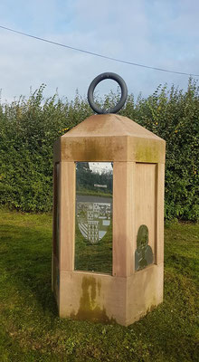
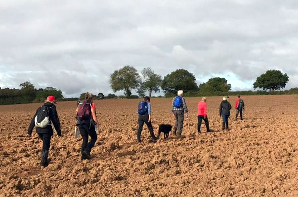
Continue along the path passing the castle and St Mary’s church and arriving at a road junction and ‘The Lantern of Arden’ where we turn right walking along the side of the road looking for a footpath on the left. Cross the road and passing through the metal gate leading to a path which continues on a diagonal to the right across arable fields eventually arriving at a small wooded area on the left where the path briefly enters the wood and then emerges onto a grassy field; continue across this field to a wide metal gate and a road; turn right and walk a short distance along the road before crossing the road and turning left to walk along Hill Top (minor road). Follow the road ahead; after a short distance another road joins from the left (looks like a T-Junction on the map; continue ahead and round to the right; Arley House Farm comes into view; the path leaves the road at this point weaving around the farm and crossing a field to the railway line where there is a crossing.
Cross the railway and follow the path ahead to a footbridge which enters Oakbridge Golf Course; once within the Golf Course keep left walking along the boundary hedge for a short distance; notice a stream on the left and look out (on the left) for a path leading down to a footbridge which crosses the stream and climbs back up into a field the other side of the stream. At this point signage is, once again vague. Continue straight into the field following a field boundary on the left and continuing up the hill past some trees; the hedge boundary ends and the field opens out at this point; head diagonally to the right towards Hood Lane Farm and a five bar gate to the left of which is the opening through which the footpath passes leading to a road and a junction with Hood Lane.
Continue ahead down Hood Lane to a T-Junction and a footpath immediately ahead. Follow the path ahead through a wooded area and over a footbridge. At this point you enter an open field with a number of options. Look to your right and notice a footpath that passes through the hedge. Take this path and pause immediately after passing through the hedge; ahead in the distance is St Lawrence Church, Ansley. Turn left at this point and continue ahead keeping the field boundary on your left. Continue ahead until you arrive at a road across which is the driveway to Rye Hills Farm. Cross the road and take the path alongside the driveway to the farm; the path heads diagonally (right) away from the driveway and then passes to the right of the farmhouse. After a short distance the path passed through a hedge boundary and turns sharp right; once more signage is not good here and the path is not clearly defined or maintained by the farmer. It is a short walk from here to a road.
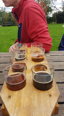
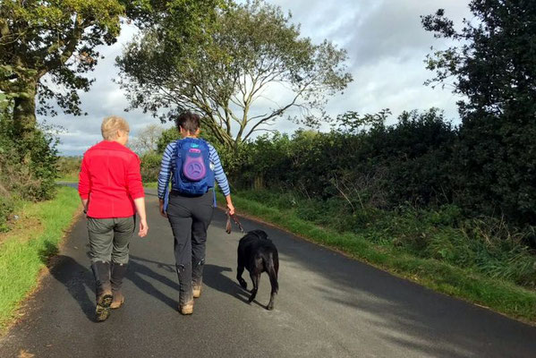
At the road turn left and continue along the road for a short distance passing a T-Junction on the left; a little further on the road turns sharply to the left which is where you leave it continuing straight and towards Birchley Farm. Just before arriving at the farm buildings the path leaves the track to the left and continues parallel to the track on the opposite side of the hedge skirting the farm (farm buildings now on your right). Continue ahead keeping the hedge boundary on your right passing wooded area on you right at which point you join the Centenary Way and continue ahead with the wooded area on you right. Pass through a metal gate at which point the Centenary Way continues through another gate to the right. Ignore this path (for now; you return here later) and continue ahead keeping the Sewage Works on your left. As you reach the end of the Sewage Works a field opens up; rather than remaining on the footpath it is possible to cut diagonally (left) across this field to a five bar metal gate and to a road. Pass through the gate and turn left walking alone the road a short distance. The entrance to the Church End Brewery (www.churchendbrewery.co.uk) is on the left (good signage this time) a couple of hundred yards along the road.
With eight hand-pulled ales on offer you might struggle to drag yourself away from the place but, when you do, retrace your steps back past the Sewage Works to the Centenary Way and to the metal gate that you walked past on your way to the brewery.
Cross the footbridge and pass through the metal gate in to a field (Lady Wood Farm – dairy and usually cows in the field as a result). In front of you are some farm buildings; head toward these. The path enters the farm via a metal gate which is not hidden but is easy to miss amongst the ‘noise’ of its surroundings. The path passes directly between the farm buildings and continues to a grassy field at which point keep the hedge boundary on your left and continue along it looking for the point at which the path crosses through the hedge. Turn left through the hedge and continue across a field to a road. To your left you will see a brick structure that was, presumably, a railway bridge in its time. Head left up the road passing through the ‘railway bridge’ to a road junction on your right where you turn right (signage to Oldbury). Continue ahead down this minor road until the road turns sharply to the left at which point you leave the road turning right and then almost immediately left to continuing on the same general bearing. After a short distance you enter a wooded area; your next turn is on the left with signage for the Centenary Way (at this point a path joins from the right which acts as a marker; look left and down at this point and Centenary Way is clearly marked). Turn left, following the Centenary Way and continuing ahead to Common Farm; rather unusually here the path enters the farm passing close to the farmhouse buildings. Keeping the farmhouse on your left walk down the driveway away from the farm towards another railway cutting.
At this point follow the path ahead (no signage) past some houses to the main road through Ansley Common. Upon reaching the road turn right, crossing the road at a convenient point. Continue to walk along the footpath for a short distance looking for a path on the left (just past a distinctive looking church and the entrance to Limes Coppice); take this path and follow it passing an allotment on your left and arriving at a gate into an arable field. Ahead of you is a wood. Cross the field to the wood looking for an entrance into the wood. Continue ahead through the wood, generally, keeping to the left and remaining on the same bearing as before. After a while the path reaches the edge of the wood and an exit on your left. Leave the wood at this point and turn right following the edge of the wood keeping it on your right. At this point you are looking down a hill towards a cottage and a tarmac track running alongside it to the right of the cottage; cross the field heading for the track; continue along the track passing the cottage and looking for a path on your right; ignore the first path; the path you are looking for is marked by a tree on which a large bird box is hung (for owls or such like). Turn right at this point leaving the track.
Follow the path ahead (Centenary Way) eventually arriving at a road and a T-Junction. The road ahead passes alongside a steep hill to the right. Head along this road keeping the hill on your right; continue past the footpath sign on your right encouraging you to walk up the steep hill and look for another path which is immediately before the first factory unit. Turn right along this path (to your left is a metal fence then a railway line and to your right the steep hill). After a short distance you pass through a metal gate into the grassy field that we crossed at the start of the walk. There is a slope ahead of you. Head up the slope and continue across the field looking for a gate in the hedge line opposite which leads to a road. As you pass through the gate your will see a road junction to your right which is the entrance to Nuthurst Crescent. Head up Nuthurst Crescent to your parked car and to the Sperrin Brewery (www.sperrinbrewery.co.uk), our second brewery of the walk, at The Lord Nelson Inn (www.thelordnelsoninnansley.co.uk) for more refreshments and food, if you wish.
