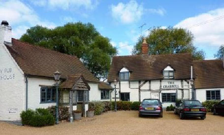
In February 2022, the Crabmill in Preston Bagot was badly damaged by a fire and its future remains uncertain. Best to start this walk at another place around the route, perhaps in Henley or in Lowsonford.
This walk from the car park at The Crabmill at Preston Bagot starts across country to the outskirts of Henley in Arden and then along the Heart of England way via Beaudesert Castle to the Millenium Way for some 2.5 miles to Copt Green. From there it proceeds via Bushwood Grange past Bush Wood to Preston Field Lane and then to the Stratford Canal for about 1/2 mile back to the Crabmill.
There are a number of steep gradients both up and down along this walk. The views over rural Warwickshire from the top of some of the hills are truly spectacular.
On leaving the Crabmill car park look for a footpath on the right which runs alongside the rear car park, through the gate maintain direction to a hedge opposite and walk along the hedge on your left. Pass the first stile reached and continue to a gate in the hedge, go through the gate and turn right walking along the same hedge but now on your right. In the corner of the field follow the path through some trees to a stile leading onto a lane, turn right along the lane until a large house is reached, keep ahead and walk along the house drive past the front of the house to a gate into a field. Through the gate take the signed path to the left diagonally across the field to a gate in the hedge at the far side, through the gate diagonally across a large dry ditch and over a stile into another field. Cross the middle of the field to a stile hidden in the hedge, over the stile turn half right to a farm track entrance, at the entrance turn half left and walk along the edge of the field with the hedge on the right to a stile leading onto Edge Lane. Cross Edge lane, over a stile slightly to the right into a field and walk along the hedge on the right to the corner of the field where the path turns right over a stile and and then goes to the left through some trees to a steep down hill section with broad steps.
At the bottom of the steps maintain direction to a gate leading into an alley way to a road, cross the road into another alley way and follow round keeping right to a gate into a field. Through the gate turn left and follow the path along the hedge, at the end of the path turn right and walk up a steep hill to the site of Beaudesert castle, at the top of the hill continue in the same direction down some steps and eventually to a second steep hill. At the top of the second hill turn left by a bench and follow Heart of England Way and Millennium Way signs, keep following Millennium Way signs along a path through trees to a stile into a field (ignore the Heart of England Way sign to the right). Over the stile you are met by a magnificent view from the top of a hill, follow the path down the steep hill going diagonally to the bottom right hand corner, turn half left through a gate and then across a field to a gate leading to a footbridge onto a lane by Holland Park Farm, turn right along the lane. The lane leads to a T-junction, turn right and immediately look for a gate on the right into a field signed Millennium Way, continue following the way marked path first going uphill and then descending more slowly to a track running alongside the entrance to Ireland's Farm. Walk along the track to another entrance to the farmyard, here take the narrower footpath to the left and follow this path under electric cables to a gap in the hedge leading onto a lane, turn left on the lane and immediately turn right along the road at Hill Barn Farm. Follow the road, Ireland Lane, for nearly a mile to a junction at Copt Green, here turn right along Bushwood Lane.
Walk along Bushwood lane for approx. 1/4 mile to a sharp right hand bend then look for a gap in the hedge on the left, go through the gap and walk along the edge of the field with the hedge on the left continue under overhead cables and just after go through a gap in the hedge and continue in the same direction with the hedge on the right to a stile onto a road. Turn right on the road and then turn right again onto another road, after some 200 yards turn left onto a tarmac track, follow the track to where it skirts left of a house and there continue through a gate onto a footpath with a fence to the right. Maintain direction along this path for approx. 1/2 mile until a gate is reached at the bottom of a hill, here turn left onto the Heart of England Way. After a short distance the path turns left into a wood and continues uphill through the wood, as it emerges from the wood follow the path with a hedge on the right to a gate, pass through the gate and immediately pass through a second gate on the right and continue for some 50 yards, here turn right onto a narrow footpath through some trees leaving the Heart of England Way. Follow this footpath which is both narrow and muddy until it emerges into a field, there maintain direction across across two fields and after going over a second stile turn sharp left with a fence on the right to a road, turn left on the road for about 100 yards and then take a track on the right when the road bends to the left.
Follow this wide but muddy track for about a mile when it runs into a road, continue along the road taking a right fork at a junction, just after a right hand bend in the road a left hand bend is reached, here look for a gate in the hedgerow on the right hand side and go through the gate into a pasture. Walk along the edge of the pasture with the hedge on the right, through a gate and turn left going past Preston Bagot church. Just past the church turn left and emerge onto the road again. Cross the road through a gate and into a field, walk along the edge of the field with the hedge on the right, at the bottom of the field follow the path into the next field and bend gently to the right keeping the hedge on the right. After some 200 yards go through a gate to the left in the hedge into a wooded area, go across a footbridge and then up the bank to the canal.
Turn right at the canal to a bridge over the canal, cross the bridge and proceed along the towpath for approx. 1/4 mile, when the towpath appears to end take a gate on the left onto a lane and walk a short distance to join the towpath again (do not cross over the canal), continue under a road bridge and just after cross the canal and go through a gate onto the road. Cross the road and turn left along the footpath back to the Crabmill.
See below for a map of the route and photos from the walk.
Click the Learn more button above to open the map in Outdooractive from where you can download the route to the free Outdooractive App for Android or iOS, or export the route to a GPX file for use in other apps.
For more about using Outdooractive, a list of all our routes with GPS files, and a link to folder with all our GPX files including HHIK0014.gpx, the file for this route, see GPS Routes.

